Mar-Mac geodata
Mar-Mac (North Carolina) is a populated place; located in United States in America/New_York (GMT-4) time zone. With population of 3,615 people, there are 8705 cities with bigger population in this country. Compared to other cities in United States, 73.5% of cities are located further ↑North; 77.7% of cities are located further ←West and 82.9% of cities have higher elevation than Mar-Mac. Note1
Administrative division(s):
- Level 1: North Carolina
- Level 2: Wayne County
- Level 3: Township of Brogden


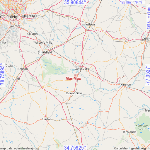
Mar-Mac GPS coordinates[2]
35° 20' 5.568" North, 78° 3' 20.952" West
| Map corner | latitude | longitude |
|---|---|---|
| Upper-left | 35.90644°, | -78.75895° |
| Center: | 35.33488°, | -78.05582° |
| Lower-right: | 34.75925°, | -77.3527° |
| Map W x H: | 127.6×127.6 km | = 79.3×79.3mi |
| max Lat: | 71.29058° ⇑73.5% North |
| Mar-Mac: | 35.33488° |
| min Lat: | ⇓26.5% South 19.06759° |
| min Long | Mar-Mac | max Long |
| -171.73463° | -78.05582° | -66.98998° |
| W 77.7%⇐ | ⇒22.3% E |
Elevation
Elevation of Mar-Mac is 35 m = 115 ft, and this is 259.8 m = 852 ft below average elevation for this country.
| Max E: |
3189 m = 10463 ft | 82.9% |
| Avg. | 294.8 m = 967 ft | |
| Mar-Mac | 35 m = 115 ft | |
Min E: |
-60 m = -197 ft | 17.1% |
See also: United States elevation on elevation.city.
Geographical zone
Mar-Mac is located in North temperate zone (between Tropic of Cancer and the Arctic Circle). Distance of this Northern Tropic circle is 1323 km =822.1 mi to South.| Distance of | km | miles | from Mar-Mac |
|---|---|---|---|
| North Pole | 6078.2 | 3776.8 | to North |
| Arctic Circle | 3472.3 | 2157.6 | to North |
| Tropic Cancer | 1323 | 822.1 | to South |
| Equator | 3928.9 | 2441.3 | to South |


Nearby cities:
15 places around Mar-Mac: (largest is in red/bold)
• Brogden
5.1 km =3.2 mi,  157°
157°
• Calypso
20.6 km =12.8 mi,  192°
192°
• Elroy
13.4 km =8.3 mi,  86°
86°
• Faison
25.4 km =15.8 mi,  196°
196°
• Fremont
24.5 km =15.2 mi,  17°
17°
• Goldsboro
8 km =5 mi,  45°
45°
• Kenly
29.7 km =18.5 mi,  347°
347°
• La Grange
24.5 km =15.2 mi,  97°
97°
• Mount Olive
15.4 km =9.6 mi,  183°
183°
• Newton Grove
28.9 km =18 mi,  249°
249°
• Pikeville
19.2 km =11.9 mi, 20°
• Pine Level
26.2 km =16.3 mi,  319°
319°
• Princeton
17.4 km =10.8 mi,  326°
326°
• Selma
30.5 km =19 mi, 317°
• Walnut Creek
17.6 km =10.9 mi, 100°
Sources, notices
• [Note1] Compared only with cities in United States existing in our database
• [Src1] Map data: © OpenStreetMap contributors (CC-BY-SA)
• [Src2] Other city data from geonames.org with taken over terms of usage.
• [Src3] Geographical zone / Annual Mean Temperature by Robert A. Rohde @ Wikipedia
