Weaverville geodata
Weaverville (North Carolina) is a populated place; located in United States in America/New_York (GMT-4) time zone. With population of 3,936 people, there are 8281 cities with bigger population in this country. Compared to other cities in United States, 71.8% of cities are located further ↑North; 63.5% of cities are located further ←West and 90.6% of cities have lower elevation than Weaverville. Note1
Administrative division(s):
- Level 1: North Carolina
- Level 2: Buncombe County
- Level 3: Township of Reems Creek


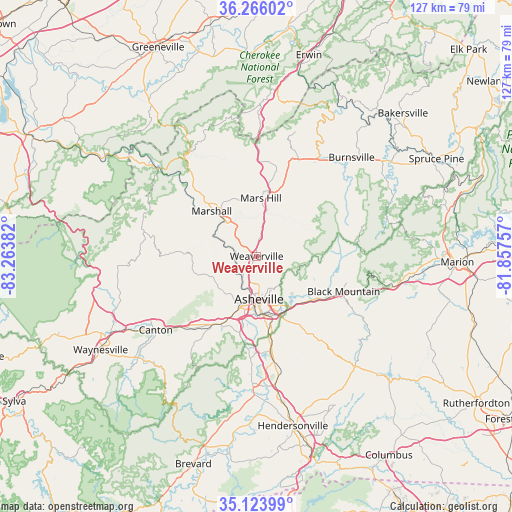
Weaverville GPS coordinates[2]
35° 41' 49.38" North, 82° 33' 38.484" West
| Map corner | latitude | longitude |
|---|---|---|
| Upper-left | 36.26602°, | -83.26382° |
| Center: | 35.69705°, | -82.56069° |
| Lower-right: | 35.12399°, | -81.85757° |
| Map W x H: | 127×127 km | = 78.9×78.9mi |
| max Lat: | 71.29058° ⇑71.8% North |
| Weaverville: | 35.69705° |
| min Lat: | ⇓28.2% South 19.06759° |
| min Long | Weaverville | max Long |
| -171.73463° | -82.56069° | -66.98998° |
| W 63.5%⇐ | ⇒36.5% E |
Elevation
Elevation of Weaverville is 665 m = 2182 ft, and this is 370.2 m = 1215 ft above average elevation for this country.
| Max E: |
3189 m = 10463 ft | 9.4% |
| Weaverville | 665 m 2182 ft | |
| Avg. | 294.8 m = 967 ft | |
Min E: |
-60 m = -197 ft | 90.6% |
See also: United States elevation on elevation.city.
Geographical zone
Weaverville is located in North temperate zone (between Tropic of Cancer and the Arctic Circle). Distance of this Northern Tropic circle is 1363.2 km =847.1 mi to South.| Distance of | km | miles | from Weaverville |
|---|---|---|---|
| North Pole | 6037.9 | 3751.8 | to North |
| Arctic Circle | 3432 | 2132.5 | to North |
| Tropic Cancer | 1363.2 | 847.1 | to South |
| Equator | 3969.1 | 2466.3 | to South |


Nearby cities:
15 places around Weaverville: (largest is in red/bold)
• Asheville
10.7 km =6.6 mi,  176°
176°
• Avery Creek
26 km =16.2 mi, 184°
• Bent Creek
21.3 km =13.2 mi,  191°
191°
• Biltmore Forest
18.4 km =11.4 mi,  170°
170°
• Black Mountain
23.4 km =14.5 mi,  112°
112°
• Canton
31 km =19.3 mi,  233°
233°
• Fairview
25.2 km =15.7 mi,  143°
143°
• Fletcher
30.1 km =18.7 mi, 169°
• Hoopers Creek
29.9 km =18.6 mi,  163°
163°
• Mars Hill
14.4 km =8.9 mi,  4°
4°
• Marshall
15.8 km =9.8 mi,  315°
315°
• Montreat
24 km =14.9 mi,  104°
104°
• Royal Pines
25 km =15.5 mi, 170°
• Swannanoa
18.2 km =11.3 mi,  127°
127°
• Woodfin
7.3 km =4.5 mi,  195°
195°
Sources, notices
• [Note1] Compared only with cities in United States existing in our database
• [Src1] Map data: © OpenStreetMap contributors (CC-BY-SA)
• [Src2] Other city data from geonames.org with taken over terms of usage.
• [Src3] Geographical zone / Annual Mean Temperature by Robert A. Rohde @ Wikipedia
