Whiteville geodata
Whiteville (North Carolina) is a seat of a second-order administrative division; located in United States in America/New_York (GMT-4) time zone. With population of 5,589 people, there are 6690 cities with bigger population in this country. Compared to other cities in United States, 78.3% of cities are located further ↑North; 76.5% of cities are located further ←West and 86.2% of cities have higher elevation than Whiteville. Note1
Administrative division(s):
- Level 1: North Carolina
- Level 2: Columbus County
- Level 3: Township of Whiteville


Whiteville GPS coordinates[2]
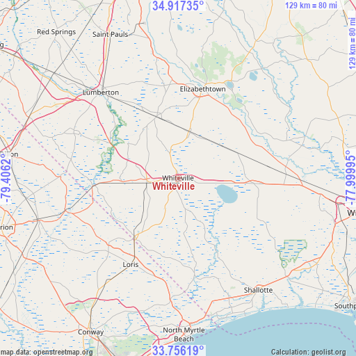
34° 20' 19.608" North, 78° 42' 11.052" West
| Map corner | latitude | longitude |
|---|---|---|
| Upper-left | 34.91735°, | -79.4062° |
| Center: | 34.33878°, | -78.70307° |
| Lower-right: | 33.75619°, | -77.99995° |
| Map W x H: | 129.1×129.1 km | = 80.2×80.2mi |
| max Lat: | 71.29058° ⇑78.3% North |
| Whiteville: | 34.33878° |
| min Lat: | ⇓21.7% South 19.06759° |
| min Long | Whiteville | max Long |
| -171.73463° | -78.70307° | -66.98998° |
| W 76.5%⇐ | ⇒23.5% E |
Elevation
Elevation of Whiteville is 25 m = 82 ft, and this is 269.8 m = 885 ft below average elevation for this country.
| Max E: |
3189 m = 10463 ft | 86.2% |
| Avg. | 294.8 m = 967 ft | |
| Whiteville | 25 m = 82 ft | |
Min E: |
-60 m = -197 ft | 13.8% |
See also: United States elevation on elevation.city.
Geographical zone
Whiteville is located in North temperate zone (between Tropic of Cancer and the Arctic Circle). Distance of this Northern Tropic circle is 1212.2 km =753.2 mi to South.| Distance of | km | miles | from Whiteville |
|---|---|---|---|
| North Pole | 6188.9 | 3845.6 | to North |
| Arctic Circle | 3583.1 | 2226.4 | to North |
| Tropic Cancer | 1212.2 | 753.2 | to South |
| Equator | 3818.1 | 2372.5 | to South |


Nearby cities:
15 places around Whiteville: (largest is in red/bold)
• Bladenboro
23.5 km =14.6 mi,  340°
340°
• Bolton
27.7 km =17.2 mi,  94°
94°
• Brunswick
5.8 km =3.6 mi,  178°
178°
• Chadbourn
11.5 km =7.1 mi,  260°
260°
• Clarkton
17.1 km =10.6 mi,  14°
14°
• Elizabethtown
33.5 km =20.8 mi,  15°
15°
• Fair Bluff
30.8 km =19.1 mi, 264°
• Fairmont
41.6 km =25.8 mi,  294°
294°
• Kelly
37.5 km =23.3 mi,  67°
67°
• Lake View
42.5 km =26.4 mi,  271°
271°
• Lake Waccamaw
18.8 km =11.7 mi,  96°
96°
• Loris
35.8 km =22.2 mi,  208°
208°
• Lumberton
42 km =26.1 mi,  317°
317°
• Tabor City
26.5 km =16.5 mi,  217°
217°
• White Lake
39.1 km =24.3 mi,  30°
30°
Sources, notices
• [Note1] Compared only with cities in United States existing in our database
• [Src1] Map data: © OpenStreetMap contributors (CC-BY-SA)
• [Src2] Other city data from geonames.org with taken over terms of usage.
• [Src3] Geographical zone / Annual Mean Temperature by Robert A. Rohde @ Wikipedia
