Brunswick geodata
Brunswick (North Carolina) is a populated place; located in United States in America/New_York (GMT-4) time zone. With population of 1,131 people, there are 15501 cities with bigger population in this country. Compared to other cities in United States, 78.5% of cities are located further ↑North; 76.5% of cities are located further ←West and 89.1% of cities have higher elevation than Brunswick. Note1
Administrative division(s):
- Level 1: North Carolina
- Level 2: Columbus County
- Level 3: Township of Whiteville


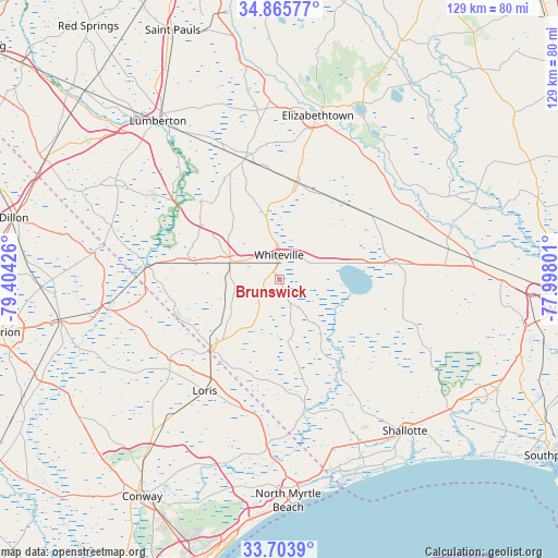
Brunswick GPS coordinates[2]
34° 17' 12.624" North, 78° 42' 4.068" West
| Map corner | latitude | longitude |
|---|---|---|
| Upper-left | 34.86577°, | -79.40426° |
| Center: | 34.28684°, | -78.70113° |
| Lower-right: | 33.7039°, | -77.99801° |
| Map W x H: | 129.2×129.2 km | = 80.3×80.3mi |
| max Lat: | 71.29058° ⇑78.5% North |
| Brunswick: | 34.28684° |
| min Lat: | ⇓21.5% South 19.06759° |
| min Long | Brunswick | max Long |
| -171.73463° | -78.70113° | -66.98998° |
| W 76.5%⇐ | ⇒23.5% E |
Elevation
Elevation of Brunswick is 18 m = 59 ft, and this is 276.8 m = 908 ft below average elevation for this country.
| Max E: |
3189 m = 10463 ft | 89.1% |
| Avg. | 294.8 m = 967 ft | |
| Brunswick | 18 m = 59 ft | |
Min E: |
-60 m = -197 ft | 10.9% |
See also: United States elevation on elevation.city.
Geographical zone
Brunswick is located in North temperate zone (between Tropic of Cancer and the Arctic Circle). Distance of this Northern Tropic circle is 1206.4 km =749.6 mi to South.| Distance of | km | miles | from Brunswick |
|---|---|---|---|
| North Pole | 6194.7 | 3849.2 | to North |
| Arctic Circle | 3588.8 | 2230 | to North |
| Tropic Cancer | 1206.4 | 749.6 | to South |
| Equator | 3812.3 | 2368.9 | to South |


Nearby cities:
15 places around Brunswick: (largest is in red/bold)
• Bladenboro
29.1 km =18.1 mi,  344°
344°
• Bolton
27.7 km =17.2 mi,  82°
82°
• Carolina Shores
44.3 km =27.5 mi,  165°
165°
• Chadbourn
12.2 km =7.6 mi,  288°
288°
• Clarkton
22.7 km =14.1 mi,  10°
10°
• Elizabethtown
39.1 km =24.3 mi, 12°
• Fair Bluff
31 km =19.3 mi,  275°
275°
• Kelly
39.9 km =24.8 mi,  60°
60°
• Lake View
43.2 km =26.8 mi, 278°
• Lake Waccamaw
18.8 km =11.7 mi, 79°
• Loris
31 km =19.3 mi,  214°
214°
• Riegelwood
44.1 km =27.4 mi, 82°
• Tabor City
22.3 km =13.9 mi,  226°
226°
• White Lake
44.1 km =27.4 mi,  26°
26°
• Whiteville
5.8 km =3.6 mi,  358°
358°
Sources, notices
• [Note1] Compared only with cities in United States existing in our database
• [Src1] Map data: © OpenStreetMap contributors (CC-BY-SA)
• [Src2] Other city data from geonames.org with taken over terms of usage.
• [Src3] Geographical zone / Annual Mean Temperature by Robert A. Rohde @ Wikipedia
