Winfall geodata
Winfall (North Carolina) is a populated place; located in United States in America/New_York (GMT-4) time zone. With population of 600 people, there are 19702 cities with bigger population in this country. Compared to other cities in United States, 69.3% of cities are located further ↑North; 82.7% of cities are located further ←West and 95.7% of cities have higher elevation than Winfall. Note1
Administrative division(s):
- Level 1: North Carolina
- Level 2: Perquimans County
- Level 3: Township of Parkville


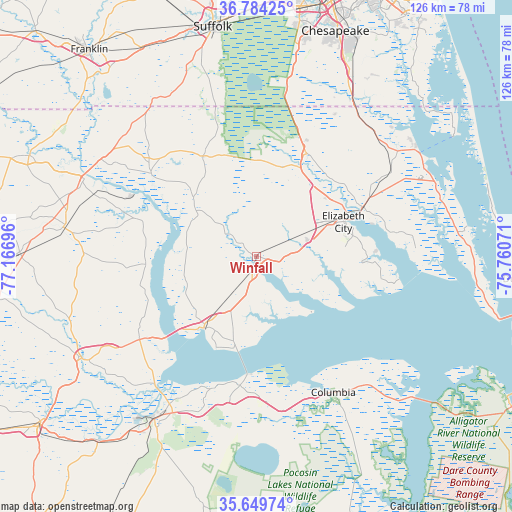
Winfall GPS coordinates[2]
36° 13' 8.58" North, 76° 27' 49.788" West
| Map corner | latitude | longitude |
|---|---|---|
| Upper-left | 36.78425°, | -77.16696° |
| Center: | 36.21905°, | -76.46383° |
| Lower-right: | 35.64974°, | -75.76071° |
| Map W x H: | 126.1×126.1 km | = 78.4×78.4mi |
| max Lat: | 71.29058° ⇑69.3% North |
| Winfall: | 36.21905° |
| min Lat: | ⇓30.7% South 19.06759° |
| min Long | Winfall | max Long |
| -171.73463° | -76.46383° | -66.98998° |
| W 82.7%⇐ | ⇒17.3% E |
Elevation
Elevation of Winfall is 8 m = 26 ft, and this is 286.8 m = 941 ft below average elevation for this country.
| Max E: |
3189 m = 10463 ft | 95.7% |
| Avg. | 294.8 m = 967 ft | |
| Winfall | 8 m = 26 ft | |
Min E: |
-60 m = -197 ft | 4.3% |
See also: United States elevation on elevation.city.
Geographical zone
Winfall is located in North temperate zone (between Tropic of Cancer and the Arctic Circle). Distance of this Northern Tropic circle is 1421.3 km =883.2 mi to South.| Distance of | km | miles | from Winfall |
|---|---|---|---|
| North Pole | 5979.9 | 3715.7 | to North |
| Arctic Circle | 3374 | 2096.5 | to North |
| Tropic Cancer | 1421.3 | 883.2 | to South |
| Equator | 4027.2 | 2502.4 | to South |


Nearby cities:
15 places around Winfall: (largest is in red/bold)
• Ahoskie
47.3 km =29.4 mi,  279°
279°
• Camden
28.9 km =18 mi,  65°
65°
• Columbia
38.5 km =23.9 mi,  150°
150°
• Currituck
47.7 km =29.6 mi,  57°
57°
• Edenton
22.1 km =13.7 mi,  215°
215°
• Elizabeth City
20.8 km =12.9 mi, 66°
• Gatesville
33 km =20.5 mi,  308°
308°
• Hertford
3.2 km =2 mi,  183°
183°
• Moyock
42.5 km =26.4 mi,  36°
36°
• Plymouth
46.8 km =29.1 mi,  213°
213°
• Roper
40.3 km =25 mi,  199°
199°
• South Suffolk
56.5 km =35.1 mi,  348°
348°
• Suffolk
57.7 km =35.9 mi, 349°
• Windsor
49.8 km =30.9 mi,  240°
240°
• Winton
46.3 km =28.8 mi,  295°
295°
Sources, notices
• [Note1] Compared only with cities in United States existing in our database
• [Src1] Map data: © OpenStreetMap contributors (CC-BY-SA)
• [Src2] Other city data from geonames.org with taken over terms of usage.
• [Src3] Geographical zone / Annual Mean Temperature by Robert A. Rohde @ Wikipedia
