Clarktown geodata
Clarktown (Ohio) is a populated place; located in United States in America/New_York (GMT-4) time zone. With population of 958 people, there are 16584 cities with bigger population in this country. Compared to other cities in United States, 56.2% of cities are located further ↑North; 62.3% of cities are located further ←West and 53% of cities have lower elevation than Clarktown. Note1


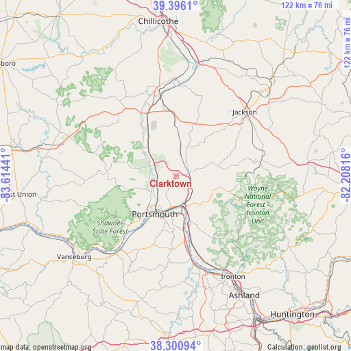
Clarktown GPS coordinates[2]
38° 51' 2.268" North, 82° 54' 40.608" West
| Map corner | latitude | longitude |
|---|---|---|
| Upper-left | 39.3961°, | -83.61441° |
| Center: | 38.85063°, | -82.91128° |
| Lower-right: | 38.30094°, | -82.20816° |
| Map W x H: | 121.8×121.8 km | = 75.7×75.7mi |
| max Lat: | 71.29058° ⇑56.2% North |
| Clarktown: | 38.85063° |
| min Lat: | ⇓43.8% South 19.06759° |
| min Long | Clarktown | max Long |
| -171.73463° | -82.91128° | -66.98998° |
| W 62.3%⇐ | ⇒37.7% E |
Elevation
Elevation of Clarktown is 210 m = 689 ft, and this is 84.8 m = 278 ft below average elevation for this country.
| Max E: |
3189 m = 10463 ft | 47% |
| Avg. | 294.8 m = 967 ft | |
| Clarktown | 210 m = 689 ft | |
Min E: |
-60 m = -197 ft | 53% |
See also: United States elevation on elevation.city.
Geographical zone
Clarktown is located in North temperate zone (between Tropic of Cancer and the Arctic Circle). Distance of this Northern Tropic circle is 1713.9 km =1065 mi to South.| Distance of | km | miles | from Clarktown |
|---|---|---|---|
| North Pole | 5687.3 | 3533.9 | to North |
| Arctic Circle | 3081.4 | 1914.7 | to North |
| Tropic Cancer | 1713.9 | 1065 | to South |
| Equator | 4319.8 | 2684.2 | to South |


Nearby cities:
15 places around Clarktown: (largest is in red/bold)
• Franklin Furnace
23.5 km =14.6 mi,  166°
166°
• Greenup
31.6 km =19.6 mi, 167°
• Lucasville
8.1 km =5 mi,  293°
293°
• Minford
4.4 km =2.7 mi,  77°
77°
• New Boston
11.2 km =7 mi,  191°
191°
• Oak Hill
29.6 km =18.4 mi, 80°
• Piketon
25.8 km =16 mi,  339°
339°
• Portsmouth
15.2 km =9.4 mi,  209°
209°
• Rosemount
9.3 km =5.8 mi,  219°
219°
• Sciotodale
11.3 km =7 mi,  160°
160°
• South Shore
15 km =9.3 mi,  195°
195°
• South Webster
16.5 km =10.3 mi,  104°
104°
• Waverly
31.4 km =19.5 mi,  348°
348°
• West Portsmouth
14.5 km =9 mi, 224°
• Wheelersburg
14.2 km =8.8 mi, 160°
Sources, notices
• [Note1] Compared only with cities in United States existing in our database
• [Src1] Map data: © OpenStreetMap contributors (CC-BY-SA)
• [Src2] Other city data from geonames.org with taken over terms of usage.
• [Src3] Geographical zone / Annual Mean Temperature by Robert A. Rohde @ Wikipedia
