Sciotodale geodata
Sciotodale (Ohio) is a populated place; located in United States in America/New_York (GMT-4) time zone. With population of 1,081 people, there are 15782 cities with bigger population in this country. Compared to other cities in United States, 56.9% of cities are located further ↑North; 62.4% of cities are located further ←West and 51.6% of cities have higher elevation than Sciotodale. Note1


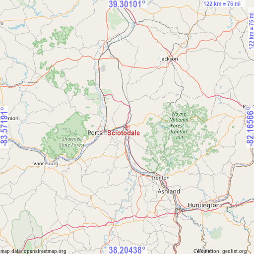
Sciotodale GPS coordinates[2]
38° 45' 17.28" North, 82° 52' 7.608" West
| Map corner | latitude | longitude |
|---|---|---|
| Upper-left | 39.30101°, | -83.57191° |
| Center: | 38.7548°, | -82.86878° |
| Lower-right: | 38.20438°, | -82.16566° |
| Map W x H: | 121.9×121.9 km | = 75.7×75.7mi |
| max Lat: | 71.29058° ⇑56.9% North |
| Sciotodale: | 38.7548° |
| min Lat: | ⇓43.1% South 19.06759° |
| min Long | Sciotodale | max Long |
| -171.73463° | -82.86878° | -66.98998° |
| W 62.4%⇐ | ⇒37.6% E |
Elevation
Elevation of Sciotodale is 192 m = 630 ft, and this is 102.8 m = 337 ft below average elevation for this country.
| Max E: |
3189 m = 10463 ft | 51.6% |
| Avg. | 294.8 m = 967 ft | |
| Sciotodale | 192 m = 630 ft | |
Min E: |
-60 m = -197 ft | 48.4% |
See also: United States elevation on elevation.city.
Geographical zone
Sciotodale is located in North temperate zone (between Tropic of Cancer and the Arctic Circle). Distance of this Northern Tropic circle is 1703.2 km =1058.3 mi to South.| Distance of | km | miles | from Sciotodale |
|---|---|---|---|
| North Pole | 5697.9 | 3540.5 | to North |
| Arctic Circle | 3092 | 1921.3 | to North |
| Tropic Cancer | 1703.2 | 1058.3 | to South |
| Equator | 4309.1 | 2677.5 | to South |


Nearby cities:
15 places around Sciotodale: (largest is in red/bold)
• Clarktown
11.3 km =7 mi,  340°
340°
• Franklin Furnace
12.3 km =7.6 mi,  171°
171°
• Greenup
20.5 km =12.7 mi, 170°
• Lucasville
17.8 km =11.1 mi,  321°
321°
• Minford
11.6 km =7.2 mi,  2°
2°
• New Boston
5.9 km =3.7 mi,  267°
267°
• Portsmouth
11.5 km =7.1 mi,  257°
257°
• Raceland
26.8 km =16.7 mi,  152°
152°
• Rosemount
10.2 km =6.3 mi,  290°
290°
• South Shore
8.6 km =5.3 mi,  244°
244°
• South Webster
13.9 km =8.6 mi,  62°
62°
• West Portsmouth
13.9 km =8.6 mi, 271°
• Wheelersburg
3 km =1.9 mi,  156°
156°
• Worthington
26.2 km =16.3 mi, 151°
• Wurtland
24.1 km =15 mi, 160°
Sources, notices
• [Note1] Compared only with cities in United States existing in our database
• [Src1] Map data: © OpenStreetMap contributors (CC-BY-SA)
• [Src2] Other city data from geonames.org with taken over terms of usage.
• [Src3] Geographical zone / Annual Mean Temperature by Robert A. Rohde @ Wikipedia
