Commercial Point geodata
Commercial Point (Ohio) is a populated place; located in United States in America/New_York (GMT-4) time zone. With population of 1,611 people, there are 13259 cities with bigger population in this country. Compared to other cities in United States, 51.3% of cities are located further ↓South; 61.9% of cities are located further ←West and 59.9% of cities have lower elevation than Commercial Point. Note1


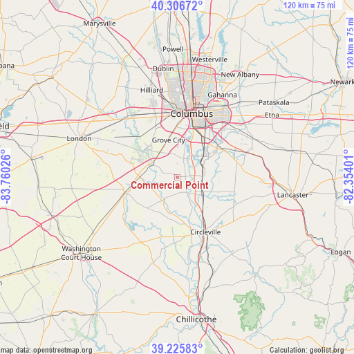
Commercial Point GPS coordinates[2]
39° 46' 6.24" North, 83° 3' 25.668" West
| Map corner | latitude | longitude |
|---|---|---|
| Upper-left | 40.30672°, | -83.76026° |
| Center: | 39.7684°, | -83.05713° |
| Lower-right: | 39.22583°, | -82.35401° |
| Map W x H: | 120.2×120.2 km | = 74.7×74.7mi |
| max Lat: | 71.29058° ⇑48.7% North |
| Commercial Point: | 39.7684° |
| min Lat: | ⇓51.3% South 19.06759° |
| min Long | Commercial Poin | max Long |
| -171.73463° | -83.05713° | -66.98998° |
| W 61.9%⇐ | ⇒38.1% E |
Elevation
Elevation of Commercial Point is 239 m = 784 ft, and this is 55.8 m = 183 ft below average elevation for this country.
| Max E: |
3189 m = 10463 ft | 40.1% |
| Avg. | 294.8 m = 967 ft | |
| Commercial Point | 239 m = 784 ft | |
Min E: |
-60 m = -197 ft | 59.9% |
See also: United States elevation on elevation.city.
Geographical zone
Commercial Point is located in North temperate zone (between Tropic of Cancer and the Arctic Circle). Distance of this Northern Tropic circle is 1815.9 km =1128.3 mi to South.| Distance of | km | miles | from Commercial Point |
|---|---|---|---|
| North Pole | 5585.2 | 3470.5 | to North |
| Arctic Circle | 2979.3 | 1851.3 | to North |
| Tropic Cancer | 1815.9 | 1128.3 | to South |
| Equator | 4421.8 | 2747.6 | to South |


Nearby cities:
15 places around Commercial Point: (largest is in red/bold)
• Ashville
10.7 km =6.6 mi,  123°
123°
• Blacklick Estates
22.4 km =13.9 mi,  47°
47°
• Circleville
20.9 km =13 mi,  152°
152°
• Columbus
22 km =13.7 mi,  13°
13°
• Darbydale
14.3 km =8.9 mi,  311°
311°
• Grove City
12.9 km =8 mi,  346°
346°
• Groveport
19.2 km =11.9 mi, 50°
• Lincoln Village
21.7 km =13.5 mi,  343°
343°
• Lithopolis
21.8 km =13.5 mi,  79°
79°
• Mount Sterling
18.6 km =11.6 mi,  253°
253°
• Obetz
15.3 km =9.5 mi,  36°
36°
• South Bloomfield
8.2 km =5.1 mi,  132°
132°
• Urbancrest
14.6 km =9.1 mi, 349°
• Valley View
22 km =13.7 mi,  356°
356°
• Williamsport
21 km =13 mi,  194°
194°
Sources, notices
• [Note1] Compared only with cities in United States existing in our database
• [Src1] Map data: © OpenStreetMap contributors (CC-BY-SA)
• [Src2] Other city data from geonames.org with taken over terms of usage.
• [Src3] Geographical zone / Annual Mean Temperature by Robert A. Rohde @ Wikipedia
