Conway geodata
Conway (South Carolina) is a seat of a second-order administrative division; located in United States in America/New_York (GMT-4) time zone. With population of 21,053 people, there are 2387 cities with bigger population in this country. Compared to other cities in United States, 81.3% of cities are located further ↑North; 75.6% of cities are located further ←West and 98.8% of cities have higher elevation than Conway. Note1


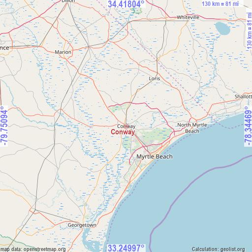
Conway GPS coordinates[2]
33° 50' 9.6" North, 79° 2' 52.116" West
| Map corner | latitude | longitude |
|---|---|---|
| Upper-left | 34.41804°, | -79.75094° |
| Center: | 33.836°, | -79.04781° |
| Lower-right: | 33.24997°, | -78.34469° |
| Map W x H: | 129.9×129.9 km | = 80.7×80.7mi |
| max Lat: | 71.29058° ⇑81.3% North |
| Conway: | 33.836° |
| min Lat: | ⇓18.7% South 19.06759° |
| min Long | Conway | max Long |
| -171.73463° | -79.04781° | -66.98998° |
| W 75.6%⇐ | ⇒24.4% E |
Elevation
Elevation of Conway is 4 m = 13 ft, and this is 290.8 m = 954 ft below average elevation for this country.
| Max E: |
3189 m = 10463 ft | 98.8% |
| Avg. | 294.8 m = 967 ft | |
| Conway | 4 m = 13 ft | |
Min E: |
-60 m = -197 ft | 1.2% |
See also: United States elevation on elevation.city.
Geographical zone
Conway is located in North temperate zone (between Tropic of Cancer and the Arctic Circle). Distance of this Northern Tropic circle is 1156.3 km =718.5 mi to South.| Distance of | km | miles | from Conway |
|---|---|---|---|
| North Pole | 6244.9 | 3880.4 | to North |
| Arctic Circle | 3639 | 2261.2 | to North |
| Tropic Cancer | 1156.3 | 718.5 | to South |
| Equator | 3762.2 | 2337.7 | to South |


Nearby cities:
15 places around Conway: (largest is in red/bold)
• Aynor
23 km =14.3 mi,  322°
322°
• Briarcliffe Acres
28.8 km =17.9 mi,  101°
101°
• Bucksport
19.7 km =12.2 mi,  194°
194°
• Forestbrook
15.1 km =9.4 mi,  146°
146°
• Garden City
27.3 km =17 mi,  172°
172°
• Johnsonville
37.1 km =23.1 mi,  266°
266°
• Loris
28.5 km =17.7 mi,  30°
30°
• Murrells Inlet
31.7 km =19.7 mi,  178°
178°
• Myrtle Beach
22.1 km =13.7 mi,  137°
137°
• North Myrtle Beach
34 km =21.1 mi,  93°
93°
• Red Hill
3.2 km =2 mi,  122°
122°
• Red Hill
26.6 km =16.5 mi,  313°
313°
• Socastee
17.6 km =10.9 mi,  164°
164°
• Surfside Beach
26.5 km =16.5 mi, 164°
• Tabor City
38.2 km =23.7 mi,  24°
24°
Sources, notices
• [Note1] Compared only with cities in United States existing in our database
• [Src1] Map data: © OpenStreetMap contributors (CC-BY-SA)
• [Src2] Other city data from geonames.org with taken over terms of usage.
• [Src3] Geographical zone / Annual Mean Temperature by Robert A. Rohde @ Wikipedia
