North Myrtle Beach geodata
North Myrtle Beach (South Carolina) is a populated place; located in United States in America/New_York (GMT-4) time zone. With population of 15,579 people, there are 3130 cities with bigger population in this country. Compared to other cities in United States, 81.5% of cities are located further ↑North; 76.6% of cities are located further ←West and 99.8% of cities have higher elevation than North Myrtle Beach. Note1


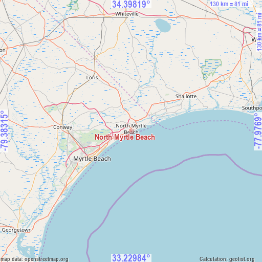
North Myrtle Beach GPS coordinates[2]
33° 48' 57.636" North, 78° 40' 48.072" West
| Map corner | latitude | longitude |
|---|---|---|
| Upper-left | 34.39819°, | -79.38315° |
| Center: | 33.81601°, | -78.68002° |
| Lower-right: | 33.22984°, | -77.9769° |
| Map W x H: | 129.9×129.9 km | = 80.7×80.7mi |
| max Lat: | 71.29058° ⇑81.5% North |
| North Myrtle Beach: | 33.81601° |
| min Lat: | ⇓18.5% South 19.06759° |
| min Long | North Myrtle Be | max Long |
| -171.73463° | -78.68002° | -66.98998° |
| W 76.6%⇐ | ⇒23.4% E |
Elevation
Elevation of North Myrtle Beach is -6 m = -20 ft, and this is 300.8 m = 987 ft below average elevation for this country.
| Max E: |
3189 m = 10463 ft | 99.8% |
| Avg. | 294.8 m = 967 ft | |
| North Myrtle Beach | -6 m = -20 ft | |
Min E: |
-60 m = -197 ft | 0.2% |
See also: United States elevation on elevation.city.
Geographical zone
North Myrtle Beach is located in North temperate zone (between Tropic of Cancer and the Arctic Circle). Distance of this Northern Tropic circle is 1154.1 km =717.1 mi to South.| Distance of | km | miles | from North Myrtle Beach |
|---|---|---|---|
| North Pole | 6247.1 | 3881.8 | to North |
| Arctic Circle | 3641.2 | 2262.5 | to North |
| Tropic Cancer | 1154.1 | 717.1 | to South |
| Equator | 3760 | 2336.4 | to South |


Nearby cities:
15 places around North Myrtle Beach: (largest is in red/bold)
• Briarcliffe Acres
6.7 km =4.2 mi,  239°
239°
• Calabash
13.2 km =8.2 mi,  51°
51°
• Carolina Shores
13.2 km =8.2 mi,  44°
44°
• Conway
34 km =21.1 mi,  273°
273°
• Forestbrook
27.7 km =17.2 mi,  247°
247°
• Holden Beach
36.4 km =22.6 mi,  72°
72°
• Little River
8.8 km =5.5 mi, 43°
• Loris
33 km =20.5 mi,  324°
324°
• Myrtle Beach
23.8 km =14.8 mi,  233°
233°
• Ocean Isle Beach
25 km =15.5 mi, 69°
• Red Hill
31.3 km =19.4 mi, 270°
• Shallotte
32.3 km =20.1 mi,  57°
57°
• Socastee
32.9 km =20.4 mi, 243°
• Sunset Beach
17.1 km =10.6 mi, 65°
• Surfside Beach
35.8 km =22.2 mi, 229°
Sources, notices
• [Note1] Compared only with cities in United States existing in our database
• [Src1] Map data: © OpenStreetMap contributors (CC-BY-SA)
• [Src2] Other city data from geonames.org with taken over terms of usage.
• [Src3] Geographical zone / Annual Mean Temperature by Robert A. Rohde @ Wikipedia
