Pacolet Mills geodata
Pacolet Mills (South Carolina) is a populated place; located in United States in America/New_York (GMT-4) time zone. With population of 956 people, there are 16596 cities with bigger population in this country. Compared to other cities in United States, 75.8% of cities are located further ↑North; 66.5% of cities are located further ←West and 57.8% of cities have higher elevation than Pacolet Mills. Note1


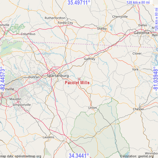
Pacolet Mills GPS coordinates[2]
34° 55' 21.468" North, 81° 44' 33.36" West
| Map corner | latitude | longitude |
|---|---|---|
| Upper-left | 35.49711°, | -82.44573° |
| Center: | 34.92263°, | -81.7426° |
| Lower-right: | 34.3441°, | -81.03948° |
| Map W x H: | 128.2×128.2 km | = 79.7×79.7mi |
| max Lat: | 71.29058° ⇑75.8% North |
| Pacolet Mills: | 34.92263° |
| min Lat: | ⇓24.2% South 19.06759° |
| min Long | Pacolet Mills | max Long |
| -171.73463° | -81.7426° | -66.98998° |
| W 66.5%⇐ | ⇒33.5% E |
Elevation
Elevation of Pacolet Mills is 166 m = 545 ft, and this is 128.8 m = 423 ft below average elevation for this country.
| Max E: |
3189 m = 10463 ft | 57.8% |
| Avg. | 294.8 m = 967 ft | |
| Pacolet Mills | 166 m = 545 ft | |
Min E: |
-60 m = -197 ft | 42.2% |
See also: United States elevation on elevation.city.
Geographical zone
Pacolet Mills is located in North temperate zone (between Tropic of Cancer and the Arctic Circle). Distance of this Northern Tropic circle is 1277.1 km =793.6 mi to South.| Distance of | km | miles | from Pacolet Mills |
|---|---|---|---|
| North Pole | 6124 | 3805.3 | to North |
| Arctic Circle | 3518.1 | 2186 | to North |
| Tropic Cancer | 1277.1 | 793.6 | to South |
| Equator | 3883 | 2412.8 | to South |


Nearby cities:
15 places around Pacolet Mills: (largest is in red/bold)
• Arcadia
23 km =14.3 mi,  279°
279°
• Buffalo
22.6 km =14 mi,  166°
166°
• Clifton
9.3 km =5.8 mi,  312°
312°
• Converse
11.4 km =7.1 mi, 312°
• Cowpens
11.9 km =7.4 mi,  331°
331°
• East Gaffney
20.2 km =12.6 mi,  29°
29°
• Gaffney
18.6 km =11.6 mi, 27°
• Jonesville
11.2 km =7 mi,  149°
149°
• Mayo
20.9 km =13 mi, 329°
• Pacolet
3.2 km =2 mi,  213°
213°
• Roebuck
20.9 km =13 mi,  256°
256°
• Saxon
20.9 km =13 mi, 281°
• Southern Shops
24 km =14.9 mi,  287°
287°
• Spartanburg
17.5 km =10.9 mi, 279°
• Valley Falls
23.6 km =14.7 mi,  296°
296°
Sources, notices
• [Note1] Compared only with cities in United States existing in our database
• [Src1] Map data: © OpenStreetMap contributors (CC-BY-SA)
• [Src2] Other city data from geonames.org with taken over terms of usage.
• [Src3] Geographical zone / Annual Mean Temperature by Robert A. Rohde @ Wikipedia
