Hanahan geodata
Hanahan (South Carolina) is a populated place; located in United States in America/New_York (GMT-4) time zone. With population of 17,997 people, there are 2782 cities with bigger population in this country. Compared to other cities in United States, 85.5% of cities are located further ↑North; 73.2% of cities are located further ←West and 89.1% of cities have higher elevation than Hanahan. Note1


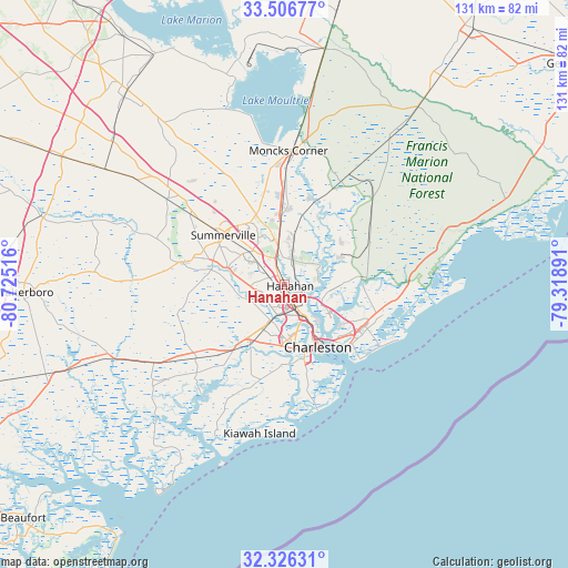
Hanahan GPS coordinates[2]
32° 55' 6.636" North, 80° 1' 19.308" West
| Map corner | latitude | longitude |
|---|---|---|
| Upper-left | 33.50677°, | -80.72516° |
| Center: | 32.91851°, | -80.02203° |
| Lower-right: | 32.32631°, | -79.31891° |
| Map W x H: | 131.3×131.3 km | = 81.6×81.6mi |
| max Lat: | 71.29058° ⇑85.5% North |
| Hanahan: | 32.91851° |
| min Lat: | ⇓14.5% South 19.06759° |
| min Long | Hanahan | max Long |
| -171.73463° | -80.02203° | -66.98998° |
| W 73.2%⇐ | ⇒26.8% E |
Elevation
Elevation of Hanahan is 18 m = 59 ft, and this is 276.8 m = 908 ft below average elevation for this country.
| Max E: |
3189 m = 10463 ft | 89.1% |
| Avg. | 294.8 m = 967 ft | |
| Hanahan | 18 m = 59 ft | |
Min E: |
-60 m = -197 ft | 10.9% |
See also: United States elevation on elevation.city.
Geographical zone
Hanahan is located in North temperate zone (between Tropic of Cancer and the Arctic Circle). Distance of this Northern Tropic circle is 1054.3 km =655.1 mi to South.| Distance of | km | miles | from Hanahan |
|---|---|---|---|
| North Pole | 6346.9 | 3943.8 | to North |
| Arctic Circle | 3741 | 2324.5 | to North |
| Tropic Cancer | 1054.3 | 655.1 | to South |
| Equator | 3660.2 | 2274.3 | to South |


Nearby cities:
15 places around Hanahan: (largest is in red/bold)
• Centerville
16.3 km =10.1 mi,  301°
301°
• Charleston
17.9 km =11.1 mi,  151°
151°
• Goose Creek
7 km =4.3 mi,  351°
351°
• Hollywood
29 km =18 mi,  225°
225°
• Isle of Palms
25.8 km =16 mi,  124°
124°
• James Island
22.4 km =13.9 mi,  165°
165°
• Ladson
11.1 km =6.9 mi,  312°
312°
• Lincolnville
15.8 km =9.8 mi, 308°
• Mount Pleasant
20.3 km =12.6 mi,  132°
132°
• North Charleston
8.4 km =5.2 mi, 148°
• Ravenel
27.4 km =17 mi, 230°
• Sangaree
16.3 km =10.1 mi,  322°
322°
• Shell Point
16.4 km =10.2 mi,  208°
208°
• Sullivans Island
24.4 km =15.2 mi, 134°
• Summerville
18.1 km =11.2 mi, 307°
Sources, notices
• [Note1] Compared only with cities in United States existing in our database
• [Src1] Map data: © OpenStreetMap contributors (CC-BY-SA)
• [Src2] Other city data from geonames.org with taken over terms of usage.
• [Src3] Geographical zone / Annual Mean Temperature by Robert A. Rohde @ Wikipedia
