Stateburg geodata
Stateburg (South Carolina) is a populated place; located in United States in America/New_York (GMT-4) time zone. With population of 1,380 people, there are 14208 cities with bigger population in this country. Compared to other cities in United States, 80.5% of cities are located further ↑North; 70.8% of cities are located further ←West and 70.8% of cities have higher elevation than Stateburg. Note1


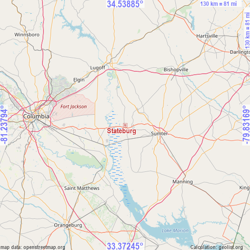
Stateburg GPS coordinates[2]
33° 57' 27.54" North, 80° 32' 5.316" West
| Map corner | latitude | longitude |
|---|---|---|
| Upper-left | 34.53885°, | -81.23794° |
| Center: | 33.95765°, | -80.53481° |
| Lower-right: | 33.37245°, | -79.83169° |
| Map W x H: | 129.7×129.7 km | = 80.6×80.6mi |
| max Lat: | 71.29058° ⇑80.5% North |
| Stateburg: | 33.95765° |
| min Lat: | ⇓19.5% South 19.06759° |
| min Long | Stateburg | max Long |
| -171.73463° | -80.53481° | -66.98998° |
| W 70.8%⇐ | ⇒29.2% E |
Elevation
Elevation of Stateburg is 96 m = 315 ft, and this is 198.8 m = 652 ft below average elevation for this country.
| Max E: |
3189 m = 10463 ft | 70.8% |
| Avg. | 294.8 m = 967 ft | |
| Stateburg | 96 m = 315 ft | |
Min E: |
-60 m = -197 ft | 29.2% |
See also: United States elevation on elevation.city.
Geographical zone
Stateburg is located in North temperate zone (between Tropic of Cancer and the Arctic Circle). Distance of this Northern Tropic circle is 1169.8 km =726.9 mi to South.| Distance of | km | miles | from Stateburg |
|---|---|---|---|
| North Pole | 6231.3 | 3871.9 | to North |
| Arctic Circle | 3625.4 | 2252.7 | to North |
| Tropic Cancer | 1169.8 | 726.9 | to South |
| Equator | 3775.7 | 2346.1 | to South |


Nearby cities:
15 places around Stateburg: (largest is in red/bold)
• Cane Savannah
10 km =6.2 mi,  128°
128°
• Cherryvale
7.1 km =4.4 mi,  91°
91°
• Dalzell
11.7 km =7.3 mi,  55°
55°
• East Sumter
22.3 km =13.9 mi,  99°
99°
• Eastover
17.1 km =10.6 mi,  238°
238°
• Gadsden
24.7 km =15.3 mi, 239°
• Lakewood
21 km =13 mi, 125°
• Millwood
15.2 km =9.4 mi,  109°
109°
• Mulberry
18.6 km =11.6 mi, 91°
• Oakland
5.1 km =3.2 mi, 56°
• Privateer
17.8 km =11.1 mi,  141°
141°
• South Sumter
18.3 km =11.4 mi, 108°
• Sumter
18.3 km =11.4 mi, 103°
• Wedgefield
7.4 km =4.6 mi,  167°
167°
• Wedgewood
8.5 km =5.3 mi, 165°
Sources, notices
• [Note1] Compared only with cities in United States existing in our database
• [Src1] Map data: © OpenStreetMap contributors (CC-BY-SA)
• [Src2] Other city data from geonames.org with taken over terms of usage.
• [Src3] Geographical zone / Annual Mean Temperature by Robert A. Rohde @ Wikipedia
