Wedgewood geodata
Wedgewood (South Carolina) is a populated place; located in United States in America/New_York (GMT-4) time zone. With population of 1,628 people, there are 13181 cities with bigger population in this country. Compared to other cities in United States, 81.1% of cities are located further ↑North; 70.8% of cities are located further ←West and 76.7% of cities have higher elevation than Wedgewood. Note1


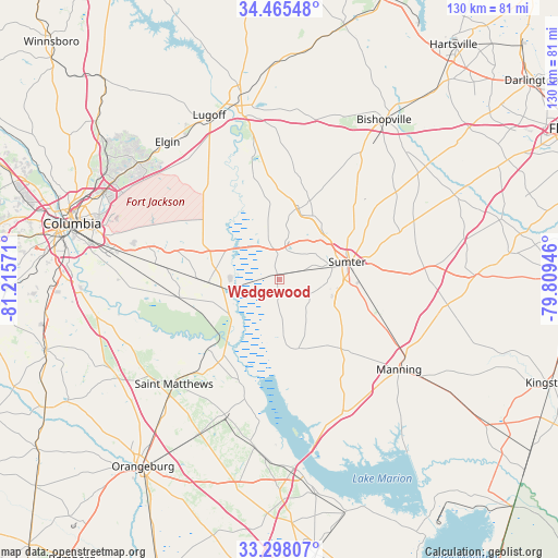
Wedgewood GPS coordinates[2]
33° 53' 1.572" North, 80° 30' 45.288" West
| Map corner | latitude | longitude |
|---|---|---|
| Upper-left | 34.46548°, | -81.21571° |
| Center: | 33.88377°, | -80.51258° |
| Lower-right: | 33.29807°, | -79.80946° |
| Map W x H: | 129.8×129.8 km | = 80.7×80.7mi |
| max Lat: | 71.29058° ⇑81.1% North |
| Wedgewood: | 33.88377° |
| min Lat: | ⇓18.9% South 19.06759° |
| min Long | Wedgewood | max Long |
| -171.73463° | -80.51258° | -66.98998° |
| W 70.8%⇐ | ⇒29.2% E |
Elevation
Elevation of Wedgewood is 62 m = 203 ft, and this is 232.8 m = 764 ft below average elevation for this country.
| Max E: |
3189 m = 10463 ft | 76.7% |
| Avg. | 294.8 m = 967 ft | |
| Wedgewood | 62 m = 203 ft | |
Min E: |
-60 m = -197 ft | 23.3% |
See also: United States elevation on elevation.city.
Geographical zone
Wedgewood is located in North temperate zone (between Tropic of Cancer and the Arctic Circle). Distance of this Northern Tropic circle is 1161.6 km =721.8 mi to South.| Distance of | km | miles | from Wedgewood |
|---|---|---|---|
| North Pole | 6239.5 | 3877 | to North |
| Arctic Circle | 3633.7 | 2257.9 | to North |
| Tropic Cancer | 1161.6 | 721.8 | to South |
| Equator | 3767.5 | 2341 | to South |


Nearby cities:
15 places around Wedgewood: (largest is in red/bold)
• Cane Savannah
6.1 km =3.8 mi,  70°
70°
• Cherryvale
9.4 km =5.8 mi,  32°
32°
• Dalzell
16.6 km =10.3 mi, 27°
• East Sumter
20.5 km =12.7 mi,  76°
76°
• Eastover
16.7 km =10.4 mi,  267°
267°
• Lakewood
15.6 km =9.7 mi,  105°
105°
• Millwood
12.8 km =8 mi, 75°
• Mulberry
18.2 km =11.3 mi, 65°
• Oakland
11.2 km =7 mi,  11°
11°
• Pinewood
16.6 km =10.3 mi,  164°
164°
• Privateer
10.7 km =6.6 mi,  121°
121°
• South Sumter
15.5 km =9.6 mi, 80°
• Stateburg
8.5 km =5.3 mi,  345°
345°
• Sumter
16.3 km =10.1 mi, 75°
• Wedgefield
1.1 km =0.7 mi,  332°
332°
Sources, notices
• [Note1] Compared only with cities in United States existing in our database
• [Src1] Map data: © OpenStreetMap contributors (CC-BY-SA)
• [Src2] Other city data from geonames.org with taken over terms of usage.
• [Src3] Geographical zone / Annual Mean Temperature by Robert A. Rohde @ Wikipedia
