Benton geodata
Benton (Tennessee) is a seat of a second-order administrative division; located in United States in America/New_York (GMT-4) time zone. With population of 1,292 people, there are 14628 cities with bigger population in this country. Compared to other cities in United States, 74.4% of cities are located further ↑North; 56.8% of cities are located further ←West and 56.7% of cities have lower elevation than Benton. Note1


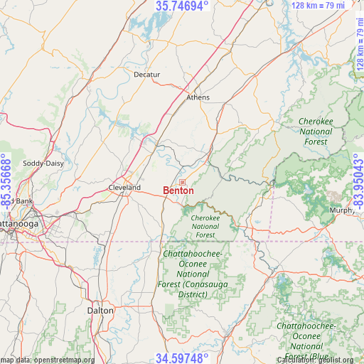
Benton GPS coordinates[2]
35° 10' 27.264" North, 84° 39' 12.78" West
| Map corner | latitude | longitude |
|---|---|---|
| Upper-left | 35.74694°, | -85.35668° |
| Center: | 35.17424°, | -84.65355° |
| Lower-right: | 34.59748°, | -83.95043° |
| Map W x H: | 127.8×127.8 km | = 79.4×79.4mi |
| max Lat: | 71.29058° ⇑74.4% North |
| Benton: | 35.17424° |
| min Lat: | ⇓25.6% South 19.06759° |
| min Long | Benton | max Long |
| -171.73463° | -84.65355° | -66.98998° |
| W 56.8%⇐ | ⇒43.2% E |
Elevation
Elevation of Benton is 225 m = 738 ft, and this is 69.8 m = 229 ft below average elevation for this country.
| Max E: |
3189 m = 10463 ft | 43.3% |
| Avg. | 294.8 m = 967 ft | |
| Benton | 225 m = 738 ft | |
Min E: |
-60 m = -197 ft | 56.7% |
See also: United States elevation on elevation.city.
Geographical zone
Benton is located in North temperate zone (between Tropic of Cancer and the Arctic Circle). Distance of this Northern Tropic circle is 1305.1 km =811 mi to South.| Distance of | km | miles | from Benton |
|---|---|---|---|
| North Pole | 6096.1 | 3787.9 | to North |
| Arctic Circle | 3490.2 | 2168.7 | to North |
| Tropic Cancer | 1305.1 | 811 | to South |
| Equator | 3911 | 2430.2 | to South |


Nearby cities:
15 places around Benton: (largest is in red/bold)
• Apison
37.6 km =23.4 mi,  243°
243°
• Athens
30.4 km =18.9 mi,  10°
10°
• Charleston
15.8 km =9.8 mi,  322°
322°
• Cleveland
20.3 km =12.6 mi,  265°
265°
• Cohutta
36.2 km =22.5 mi,  228°
228°
• Collegedale
38.5 km =23.9 mi,  249°
249°
• East Cleveland
18.6 km =11.6 mi, 265°
• Englewood
31.6 km =19.6 mi,  28°
28°
• Etowah
20.3 km =12.6 mi,  35°
35°
• Hopewell
22.3 km =13.9 mi,  287°
287°
• McCaysville
33.1 km =20.6 mi,  129°
129°
• Riceville
23.7 km =14.7 mi,  351°
351°
• South Cleveland
20.2 km =12.6 mi,  259°
259°
• Tellico Plains
38.8 km =24.1 mi,  57°
57°
• Wildwood Lake
20.4 km =12.7 mi, 243°
Sources, notices
• [Note1] Compared only with cities in United States existing in our database
• [Src1] Map data: © OpenStreetMap contributors (CC-BY-SA)
• [Src2] Other city data from geonames.org with taken over terms of usage.
• [Src3] Geographical zone / Annual Mean Temperature by Robert A. Rohde @ Wikipedia
