New Union geodata
New Union (Tennessee) is a populated place; located in United States in America/Chicago (GMT-5) time zone. With population of 1,431 people, there are 13956 cities with bigger population in this country. Compared to other cities in United States, 72.5% of cities are located further ↑North; 52.7% of cities are located further ←West and 77.4% of cities have lower elevation than New Union. Note1


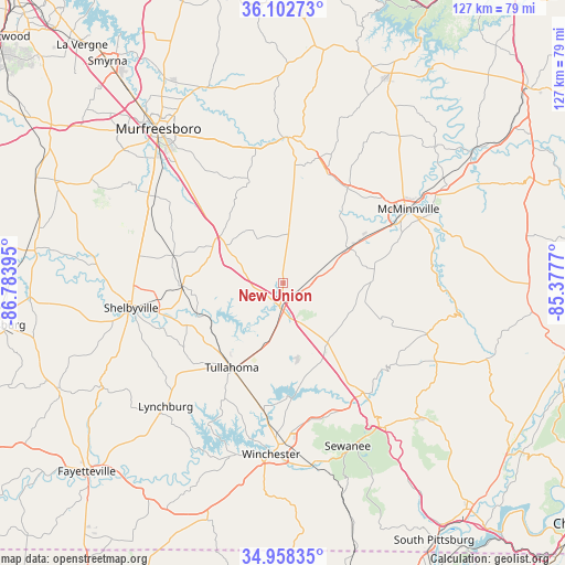
New Union GPS coordinates[2]
35° 31' 57.288" North, 86° 4' 50.952" West
| Map corner | latitude | longitude |
|---|---|---|
| Upper-left | 36.10273°, | -86.78395° |
| Center: | 35.53258°, | -86.08082° |
| Lower-right: | 34.95835°, | -85.3777° |
| Map W x H: | 127.2×127.2 km | = 79×79mi |
| max Lat: | 71.29058° ⇑72.5% North |
| New Union: | 35.53258° |
| min Lat: | ⇓27.5% South 19.06759° |
| min Long | New Union | max Long |
| -171.73463° | -86.08082° | -66.98998° |
| W 52.7%⇐ | ⇒47.3% E |
Elevation
Elevation of New Union is 331 m = 1086 ft, and this is 36.2 m = 119 ft above average elevation for this country.
| Max E: |
3189 m = 10463 ft | 22.6% |
| New Union | 331 m 1086 ft | |
| Avg. | 294.8 m = 967 ft | |
Min E: |
-60 m = -197 ft | 77.4% |
See also: United States elevation on elevation.city.
Geographical zone
New Union is located in North temperate zone (between Tropic of Cancer and the Arctic Circle). Distance of this Northern Tropic circle is 1344.9 km =835.7 mi to South.| Distance of | km | miles | from New Union |
|---|---|---|---|
| North Pole | 6056.2 | 3763.1 | to North |
| Arctic Circle | 3450.3 | 2143.9 | to North |
| Tropic Cancer | 1344.9 | 835.7 | to South |
| Equator | 3950.9 | 2455 | to South |


Nearby cities:
15 places around New Union: (largest is in red/bold)
• Altamont
34.4 km =21.4 mi,  109°
109°
• Bell Buckle
25.6 km =15.9 mi,  284°
284°
• Christiana
34.9 km =21.7 mi,  304°
304°
• Decherd
35.9 km =22.3 mi,  179°
179°
• Estill Springs
29.4 km =18.3 mi,  188°
188°
• Lakewood Park
13.8 km =8.6 mi,  339°
339°
• Lynchburg
38.4 km =23.9 mi,  223°
223°
• Manchester
5.7 km =3.5 mi, 187°
• McMinnville
32.7 km =20.3 mi,  59°
59°
• Morrison
16.5 km =10.3 mi, 61°
• Shelbyville
34.8 km =21.6 mi,  260°
260°
• Tullahoma
22.3 km =13.9 mi,  211°
211°
• Wartrace
22.9 km =14.2 mi,  268°
268°
• Winchester
38.6 km =24 mi, 184°
• Woodbury
32.8 km =20.4 mi,  1°
1°
Sources, notices
• [Note1] Compared only with cities in United States existing in our database
• [Src1] Map data: © OpenStreetMap contributors (CC-BY-SA)
• [Src2] Other city data from geonames.org with taken over terms of usage.
• [Src3] Geographical zone / Annual Mean Temperature by Robert A. Rohde @ Wikipedia
