Palmer geodata
Palmer (Tennessee) is a populated place; located in United States in America/Chicago (GMT-5) time zone. With population of 662 people, there are 19049 cities with bigger population in this country. Compared to other cities in United States, 73.4% of cities are located further ↑North; 54.4% of cities are located further ←West and 88.8% of cities have lower elevation than Palmer. Note1


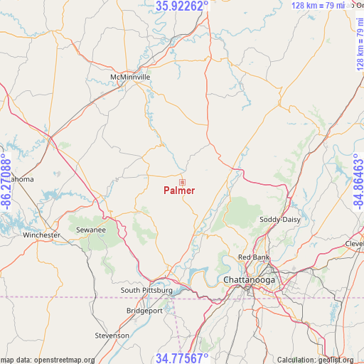
Palmer GPS coordinates[2]
35° 21' 4.248" North, 85° 34' 3.9" West
| Map corner | latitude | longitude |
|---|---|---|
| Upper-left | 35.92262°, | -86.27088° |
| Center: | 35.35118°, | -85.56775° |
| Lower-right: | 34.77567°, | -84.86463° |
| Map W x H: | 127.5×127.5 km | = 79.2×79.2mi |
| max Lat: | 71.29058° ⇑73.4% North |
| Palmer: | 35.35118° |
| min Lat: | ⇓26.6% South 19.06759° |
| min Long | Palmer | max Long |
| -171.73463° | -85.56775° | -66.98998° |
| W 54.4%⇐ | ⇒45.6% E |
Elevation
Elevation of Palmer is 550 m = 1804 ft, and this is 255.2 m = 837 ft above average elevation for this country.
| Max E: |
3189 m = 10463 ft | 11.2% |
| Palmer | 550 m 1804 ft | |
| Avg. | 294.8 m = 967 ft | |
Min E: |
-60 m = -197 ft | 88.8% |
See also: United States elevation on elevation.city.
Geographical zone
Palmer is located in North temperate zone (between Tropic of Cancer and the Arctic Circle). Distance of this Northern Tropic circle is 1324.8 km =823.2 mi to South.| Distance of | km | miles | from Palmer |
|---|---|---|---|
| North Pole | 6076.4 | 3775.7 | to North |
| Arctic Circle | 3470.5 | 2156.5 | to North |
| Tropic Cancer | 1324.8 | 823.2 | to South |
| Equator | 3930.7 | 2442.4 | to South |


Nearby cities:
15 places around Palmer: (largest is in red/bold)
• Altamont
16.6 km =10.3 mi,  301°
301°
• Coalmont
12.5 km =7.8 mi,  263°
263°
• Dunlap
16.2 km =10.1 mi,  82°
82°
• Fairmount
29.1 km =18.1 mi,  130°
130°
• Falling Water
32.9 km =20.4 mi,  119°
119°
• Gruetli-Laager
5.1 km =3.2 mi, 297°
• Jasper
31.2 km =19.4 mi,  189°
189°
• Lone Oak
24.9 km =15.5 mi, 132°
• Monteagle
27.6 km =17.1 mi,  243°
243°
• Mowbray Mountain
32.4 km =20.1 mi,  105°
105°
• Powells Crossroads
19.5 km =12.1 mi,  157°
157°
• Signal Mountain
32.6 km =20.3 mi,  141°
141°
• Tracy City
18.3 km =11.4 mi, 236°
• Walden
31.9 km =19.8 mi, 130°
• Whitwell
17.2 km =10.7 mi,  165°
165°
Sources, notices
• [Note1] Compared only with cities in United States existing in our database
• [Src1] Map data: © OpenStreetMap contributors (CC-BY-SA)
• [Src2] Other city data from geonames.org with taken over terms of usage.
• [Src3] Geographical zone / Annual Mean Temperature by Robert A. Rohde @ Wikipedia
