Powells Crossroads geodata
Powells Crossroads (Tennessee) is a populated place; located in United States in America/Chicago (GMT-5) time zone. With population of 1,317 people, there are 14512 cities with bigger population in this country. Compared to other cities in United States, 74.4% of cities are located further ↑North; 54.7% of cities are located further ←West and 52.5% of cities have lower elevation than Powells Crossroads. Note1


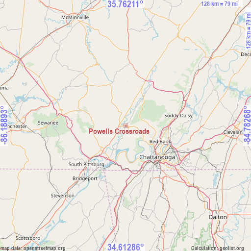
Powells Crossroads GPS coordinates[2]
35° 11' 22.272" North, 85° 29' 8.88" West
| Map corner | latitude | longitude |
|---|---|---|
| Upper-left | 35.76211°, | -86.18893° |
| Center: | 35.18952°, | -85.4858° |
| Lower-right: | 34.61286°, | -84.78268° |
| Map W x H: | 127.8×127.8 km | = 79.4×79.4mi |
| max Lat: | 71.29058° ⇑74.4% North |
| Powells Crossroads: | 35.18952° |
| min Lat: | ⇓25.6% South 19.06759° |
| min Long | Powells Crossro | max Long |
| -171.73463° | -85.4858° | -66.98998° |
| W 54.7%⇐ | ⇒45.3% E |
Elevation
Elevation of Powells Crossroads is 208 m = 682 ft, and this is 86.8 m = 285 ft below average elevation for this country.
| Max E: |
3189 m = 10463 ft | 47.5% |
| Avg. | 294.8 m = 967 ft | |
| Powells Crossroads | 208 m = 682 ft | |
Min E: |
-60 m = -197 ft | 52.5% |
See also: United States elevation on elevation.city.
Geographical zone
Powells Crossroads is located in North temperate zone (between Tropic of Cancer and the Arctic Circle). Distance of this Northern Tropic circle is 1306.8 km =812 mi to South.| Distance of | km | miles | from Powells Crossroads |
|---|---|---|---|
| North Pole | 6094.4 | 3786.9 | to North |
| Arctic Circle | 3488.5 | 2167.7 | to North |
| Tropic Cancer | 1306.8 | 812 | to South |
| Equator | 3912.7 | 2431.2 | to South |


Nearby cities:
15 places around Powells Crossroads: (largest is in red/bold)
• Chattanooga
22.6 km =14 mi,  134°
134°
• Dunlap
22 km =13.7 mi,  23°
23°
• Fairmount
14.8 km =9.2 mi,  93°
93°
• Falling Water
21.2 km =13.2 mi, 85°
• Gruetli-Laager
23.6 km =14.7 mi,  329°
329°
• Jasper
18.1 km =11.2 mi,  224°
224°
• Kimball
23.1 km =14.4 mi,  227°
227°
• Lone Oak
11.1 km =6.9 mi,  83°
83°
• Lookout Mountain
25 km =15.5 mi,  150°
150°
• Palmer
19.5 km =12.1 mi,  337°
337°
• Red Bank
19.4 km =12.1 mi,  116°
116°
• Signal Mountain
14.9 km =9.3 mi, 119°
• Tracy City
24.1 km =15 mi,  289°
289°
• Walden
17 km =10.6 mi,  99°
99°
• Whitwell
3.3 km =2.1 mi, 293°
Sources, notices
• [Note1] Compared only with cities in United States existing in our database
• [Src1] Map data: © OpenStreetMap contributors (CC-BY-SA)
• [Src2] Other city data from geonames.org with taken over terms of usage.
• [Src3] Geographical zone / Annual Mean Temperature by Robert A. Rohde @ Wikipedia
