Burleson geodata
Burleson (Texas) is a populated place; located in United States in America/Chicago (GMT-5) time zone. With population of 43,625 people, there are 1094 cities with bigger population in this country. Compared to other cities in United States, 86.9% of cities are located further ↑North; 76.6% of cities are located further →East and 55.4% of cities have lower elevation than Burleson. Note1


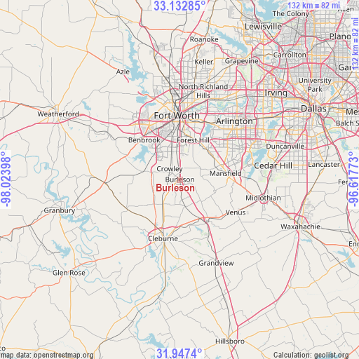
Burleson GPS coordinates[2]
32° 32' 31.488" North, 97° 19' 15.06" West
| Map corner | latitude | longitude |
|---|---|---|
| Upper-left | 33.13285°, | -98.02398° |
| Center: | 32.54208°, | -97.32085° |
| Lower-right: | 31.9474°, | -96.61773° |
| Map W x H: | 131.8×131.8 km | = 81.9×81.9mi |
| max Lat: | 71.29058° ⇑86.9% North |
| Burleson: | 32.54208° |
| min Lat: | ⇓13.1% South 19.06759° |
| min Long | Burleson | max Long |
| -171.73463° | -97.32085° | -66.98998° |
| W 23.4%⇐ | ⇒76.6% E |
Elevation
Elevation of Burleson is 220 m = 722 ft, and this is 74.8 m = 245 ft below average elevation for this country.
| Max E: |
3189 m = 10463 ft | 44.6% |
| Avg. | 294.8 m = 967 ft | |
| Burleson | 220 m = 722 ft | |
Min E: |
-60 m = -197 ft | 55.4% |
See also: Burleson elevation on elevation.city.
Geographical zone
Burleson is located in North temperate zone (between Tropic of Cancer and the Arctic Circle). Distance of this Northern Tropic circle is 1012.4 km =629.1 mi to South.| Distance of | km | miles | from Burleson |
|---|---|---|---|
| North Pole | 6388.7 | 3969.8 | to North |
| Arctic Circle | 3782.8 | 2350.5 | to North |
| Tropic Cancer | 1012.4 | 629.1 | to South |
| Equator | 3618.3 | 2248.3 | to South |


Nearby cities:
15 places around Burleson: (largest is in red/bold)
• Alvarado
18.2 km =11.3 mi,  145°
145°
• Benbrook
19.6 km =12.2 mi,  318°
318°
• Cleburne
22.5 km =14 mi,  195°
195°
• Crowley
5.7 km =3.5 mi, 316°
• Dalworthington Gardens
23.7 km =14.7 mi,  40°
40°
• Edgecliff Village
13 km =8.1 mi,  350°
350°
• Everman
10.3 km =6.4 mi,  16°
16°
• Forest Hill
15.2 km =9.4 mi, 18°
• Fort Worth
20.4 km =12.7 mi,  0°
0°
• Godley
21.9 km =13.6 mi,  241°
241°
• Joshua
11 km =6.8 mi,  215°
215°
• Keene
16.2 km =10.1 mi,  181°
181°
• Kennedale
14.7 km =9.1 mi, 37°
• Mansfield
17 km =10.6 mi,  82°
82°
• Rendon
8.4 km =5.2 mi,  62°
62°
Sources, notices
• [Note1] Compared only with cities in United States existing in our database
• [Src1] Map data: © OpenStreetMap contributors (CC-BY-SA)
• [Src2] Other city data from geonames.org with taken over terms of usage.
• [Src3] Geographical zone / Annual Mean Temperature by Robert A. Rohde @ Wikipedia
