Joshua geodata
Joshua (Texas) is a populated place; located in United States in America/Chicago (GMT-5) time zone. With population of 6,066 people, there are 6360 cities with bigger population in this country. Compared to other cities in United States, 87.3% of cities are located further ↑North; 76.8% of cities are located further →East and 70.6% of cities have lower elevation than Joshua. Note1


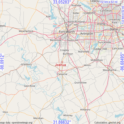
Joshua GPS coordinates[2]
32° 27' 41.508" North, 97° 23' 17.052" West
| Map corner | latitude | longitude |
|---|---|---|
| Upper-left | 33.05283°, | -98.0912° |
| Center: | 32.46153°, | -97.38807° |
| Lower-right: | 31.86632°, | -96.68495° |
| Map W x H: | 131.9×131.9 km | = 82×82mi |
| max Lat: | 71.29058° ⇑87.3% North |
| Joshua: | 32.46153° |
| min Lat: | ⇓12.7% South 19.06759° |
| min Long | Joshua | max Long |
| -171.73463° | -97.38807° | -66.98998° |
| W 23.2%⇐ | ⇒76.8% E |
Elevation
Elevation of Joshua is 289 m = 948 ft, and this is 5.8 m = 19 ft below average elevation for this country.
| Max E: |
3189 m = 10463 ft | 29.4% |
| Avg. | 294.8 m = 967 ft | |
| Joshua | 289 m = 948 ft | |
Min E: |
-60 m = -197 ft | 70.6% |
See also: United States elevation on elevation.city.
Geographical zone
Joshua is located in North temperate zone (between Tropic of Cancer and the Arctic Circle). Distance of this Northern Tropic circle is 1003.5 km =623.5 mi to South.| Distance of | km | miles | from Joshua |
|---|---|---|---|
| North Pole | 6397.7 | 3975.3 | to North |
| Arctic Circle | 3791.8 | 2356.1 | to North |
| Tropic Cancer | 1003.5 | 623.5 | to South |
| Equator | 3609.4 | 2242.8 | to South |


Nearby cities:
15 places around Joshua: (largest is in red/bold)
• Alvarado
17.6 km =10.9 mi,  110°
110°
• Benbrook
24.5 km =15.2 mi,  343°
343°
• Burleson
11 km =6.8 mi,  35°
35°
• Cleburne
12.7 km =7.9 mi,  179°
179°
• Cresson
22.9 km =14.2 mi,  290°
290°
• Crowley
13.3 km =8.3 mi,  10°
10°
• Edgecliff Village
22.2 km =13.8 mi, 11°
• Everman
21 km =13 mi,  26°
26°
• Forest Hill
25.9 km =16.1 mi, 25°
• Godley
13.1 km =8.1 mi,  263°
263°
• Keene
9.4 km =5.8 mi,  140°
140°
• Kennedale
25.6 km =15.9 mi, 36°
• Mansfield
25.7 km =16 mi,  63°
63°
• Rendon
18.8 km =11.7 mi,  47°
47°
• Rio Vista
25.4 km =15.8 mi, 177°
Sources, notices
• [Note1] Compared only with cities in United States existing in our database
• [Src1] Map data: © OpenStreetMap contributors (CC-BY-SA)
• [Src2] Other city data from geonames.org with taken over terms of usage.
• [Src3] Geographical zone / Annual Mean Temperature by Robert A. Rohde @ Wikipedia
