Pilot Point geodata
Pilot Point (Texas) is a populated place; located in United States in America/Chicago (GMT-5) time zone. With population of 4,093 people, there are 8108 cities with bigger population in this country. Compared to other cities in United States, 83.6% of cities are located further ↑North; 75.6% of cities are located further →East and 56.1% of cities have lower elevation than Pilot Point. Note1


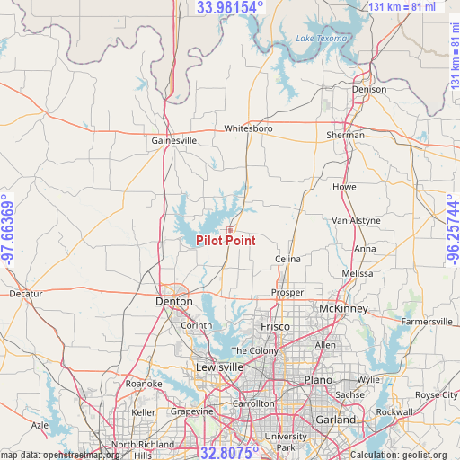
Pilot Point GPS coordinates[2]
33° 23' 47.4" North, 96° 57' 38.016" West
| Map corner | latitude | longitude |
|---|---|---|
| Upper-left | 33.98154°, | -97.66369° |
| Center: | 33.3965°, | -96.96056° |
| Lower-right: | 32.8075°, | -96.25744° |
| Map W x H: | 130.5×130.5 km | = 81.1×81.1mi |
| max Lat: | 71.29058° ⇑83.6% North |
| Pilot Point: | 33.3965° |
| min Lat: | ⇓16.4% South 19.06759° |
| min Long | Pilot Point | max Long |
| -171.73463° | -96.96056° | -66.98998° |
| W 24.4%⇐ | ⇒75.6% E |
Elevation
Elevation of Pilot Point is 223 m = 732 ft, and this is 71.8 m = 236 ft below average elevation for this country.
| Max E: |
3189 m = 10463 ft | 43.9% |
| Avg. | 294.8 m = 967 ft | |
| Pilot Point | 223 m = 732 ft | |
Min E: |
-60 m = -197 ft | 56.1% |
See also: United States elevation on elevation.city.
Geographical zone
Pilot Point is located in North temperate zone (between Tropic of Cancer and the Arctic Circle). Distance of this Northern Tropic circle is 1107.4 km =688.1 mi to South.| Distance of | km | miles | from Pilot Point |
|---|---|---|---|
| North Pole | 6293.7 | 3910.7 | to North |
| Arctic Circle | 3687.8 | 2291.5 | to North |
| Tropic Cancer | 1107.4 | 688.1 | to South |
| Equator | 3713.3 | 2307.3 | to South |


Nearby cities:
15 places around Pilot Point: (largest is in red/bold)
• Aubrey
10.5 km =6.5 mi,  193°
193°
• Celina
18.2 km =11.3 mi,  116°
116°
• Collinsville
18.9 km =11.7 mi,  14°
14°
• Cross Roads
18.8 km =11.7 mi, 191°
• Gunter
20.6 km =12.8 mi,  73°
73°
• Krugerville
13.1 km =8.1 mi, 192°
• Lake Kiowa
20.7 km =12.9 mi,  346°
346°
• New Hope (historical)
18.2 km =11.3 mi, 188°
• Paloma Creek
19.2 km =11.9 mi,  173°
173°
• Paloma Creek South
20.7 km =12.9 mi, 173°
• Providence
18.1 km =11.2 mi,  180°
180°
• Sanger
20.2 km =12.6 mi,  259°
259°
• Savannah
19.6 km =12.2 mi, 165°
• Tioga
8.7 km =5.4 mi,  26°
26°
• Valley View
21.5 km =13.4 mi,  298°
298°
Sources, notices
• [Note1] Compared only with cities in United States existing in our database
• [Src1] Map data: © OpenStreetMap contributors (CC-BY-SA)
• [Src2] Other city data from geonames.org with taken over terms of usage.
• [Src3] Geographical zone / Annual Mean Temperature by Robert A. Rohde @ Wikipedia
