Waco geodata
Waco (Texas) is a seat of a second-order administrative division; located in United States in America/Chicago (GMT-5) time zone. With population of 132,356 people, there are 229 cities with bigger population in this country. Compared to other cities in United States, 89.5% of cities are located further ↑North; 76.2% of cities are located further →East and 61.5% of cities have higher elevation than Waco. Note1


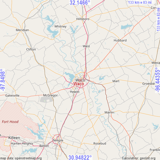
Waco GPS coordinates[2]
31° 32' 57.588" North, 97° 8' 48.012" West
| Map corner | latitude | longitude |
|---|---|---|
| Upper-left | 32.1466°, | -97.8498° |
| Center: | 31.54933°, | -97.14667° |
| Lower-right: | 30.94822°, | -96.44355° |
| Map W x H: | 133.2×133.2 km | = 82.8×82.8mi |
| max Lat: | 71.29058° ⇑89.5% North |
| Waco: | 31.54933° |
| min Lat: | ⇓10.5% South 19.06759° |
| min Long | Waco | max Long |
| -171.73463° | -97.14667° | -66.98998° |
| W 23.8%⇐ | ⇒76.2% E |
Elevation
Elevation of Waco is 147 m = 482 ft, and this is 147.8 m = 485 ft below average elevation for this country.
| Max E: |
3189 m = 10463 ft | 61.5% |
| Avg. | 294.8 m = 967 ft | |
| Waco | 147 m = 482 ft | |
Min E: |
-60 m = -197 ft | 38.5% |
See also: Waco elevation on elevation.city.
Geographical zone
Waco is located in North temperate zone (between Tropic of Cancer and the Arctic Circle). Distance of this Northern Tropic circle is 902 km =560.5 mi to South.| Distance of | km | miles | from Waco |
|---|---|---|---|
| North Pole | 6499.1 | 4038.4 | to North |
| Arctic Circle | 3893.2 | 2419.1 | to North |
| Tropic Cancer | 902 | 560.5 | to South |
| Equator | 3508 | 2179.8 | to South |


Nearby cities:
15 places around Waco: (largest is in red/bold)
• Bellmead
6.1 km =3.8 mi,  35°
35°
• Beverly
2.7 km =1.7 mi,  170°
170°
• Beverly Hills
3.2 km =2 mi,  192°
192°
• Crawford
28.1 km =17.5 mi,  266°
266°
• Gholson
18.1 km =11.2 mi,  338°
338°
• Golinda
20 km =12.4 mi,  162°
162°
• Hallsburg
18.1 km =11.2 mi,  93°
93°
• Hewitt
10.7 km =6.6 mi,  205°
205°
• Lacy-Lakeview
9.8 km =6.1 mi,  25°
25°
• Lorena
19.2 km =11.9 mi,  199°
199°
• McGregor
27.5 km =17.1 mi,  244°
244°
• Northcrest
10.7 km =6.6 mi,  24°
24°
• Riesel
22.7 km =14.1 mi,  111°
111°
• Robinson
9.6 km =6 mi, 161°
• Woodway
7.3 km =4.5 mi,  228°
228°
Sources, notices
• [Note1] Compared only with cities in United States existing in our database
• [Src1] Map data: © OpenStreetMap contributors (CC-BY-SA)
• [Src2] Other city data from geonames.org with taken over terms of usage.
• [Src3] Geographical zone / Annual Mean Temperature by Robert A. Rohde @ Wikipedia
