Wildwood geodata
Wildwood (Texas) is a populated place; located in United States in America/Chicago (GMT-5) time zone. With population of 1,235 people, there are 14924 cities with bigger population in this country. Compared to other cities in United States, 91.7% of cities are located further ↑North; 69.7% of cities are located further →East and 80.6% of cities have higher elevation than Wildwood. Note1


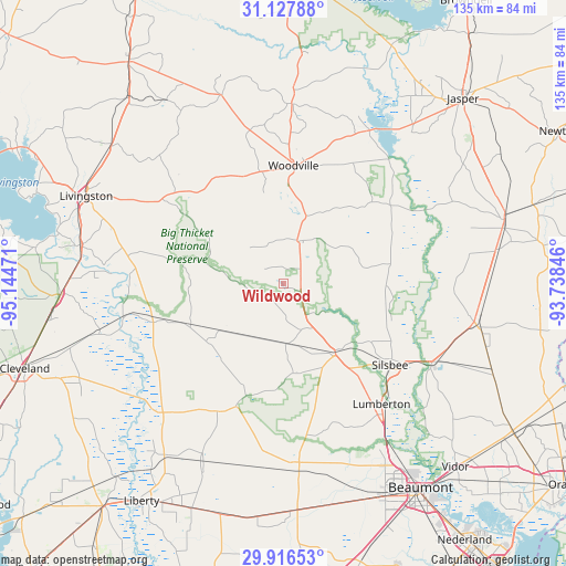
Wildwood GPS coordinates[2]
30° 31' 26.724" North, 94° 26' 29.688" West
| Map corner | latitude | longitude |
|---|---|---|
| Upper-left | 31.12788°, | -95.14471° |
| Center: | 30.52409°, | -94.44158° |
| Lower-right: | 29.91653°, | -93.73846° |
| Map W x H: | 134.7×134.7 km | = 83.7×83.7mi |
| max Lat: | 71.29058° ⇑91.7% North |
| Wildwood: | 30.52409° |
| min Lat: | ⇓8.3% South 19.06759° |
| min Long | Wildwood | max Long |
| -171.73463° | -94.44158° | -66.98998° |
| W 30.3%⇐ | ⇒69.7% E |
Elevation
Elevation of Wildwood is 44 m = 144 ft, and this is 250.8 m = 823 ft below average elevation for this country.
| Max E: |
3189 m = 10463 ft | 80.6% |
| Avg. | 294.8 m = 967 ft | |
| Wildwood | 44 m = 144 ft | |
Min E: |
-60 m = -197 ft | 19.4% |
See also: United States elevation on elevation.city.
Geographical zone
Wildwood is located in North temperate zone (between Tropic of Cancer and the Arctic Circle). Distance of this Northern Tropic circle is 788 km =489.6 mi to South.| Distance of | km | miles | from Wildwood |
|---|---|---|---|
| North Pole | 6613.1 | 4109.2 | to North |
| Arctic Circle | 4007.2 | 2490 | to North |
| Tropic Cancer | 788 | 489.6 | to South |
| Equator | 3394 | 2108.9 | to South |


Nearby cities:
15 places around Wildwood: (largest is in red/bold)
• Bevil Oaks
44.7 km =27.8 mi,  158°
158°
• Buna
47 km =29.2 mi,  102°
102°
• Colmesneil
42.7 km =26.5 mi,  2°
2°
• Daisetta
49.6 km =30.8 mi,  202°
202°
• Evadale
40.1 km =24.9 mi,  118°
118°
• Hardin
50.2 km =31.2 mi,  214°
214°
• Hull
46.2 km =28.7 mi, 204°
• Indian Springs
35.4 km =22 mi,  302°
302°
• Kountze
21 km =13 mi,  143°
143°
• Lumberton
36.9 km =22.9 mi, 141°
• Pinewood Estates
41.6 km =25.8 mi, 163°
• Silsbee
31.9 km =19.8 mi,  127°
127°
• Sour Lake
42.8 km =26.6 mi,  176°
176°
• Warren
10.6 km =6.6 mi,  17°
17°
• Woodville
28 km =17.4 mi,  5°
5°
Sources, notices
• [Note1] Compared only with cities in United States existing in our database
• [Src1] Map data: © OpenStreetMap contributors (CC-BY-SA)
• [Src2] Other city data from geonames.org with taken over terms of usage.
• [Src3] Geographical zone / Annual Mean Temperature by Robert A. Rohde @ Wikipedia
