Bealeton geodata
Bealeton (Virginia) is a populated place; located in United States in America/New_York (GMT-4) time zone. With population of 4,435 people, there are 7710 cities with bigger population in this country. Compared to other cities in United States, 58.3% of cities are located further ↑North; 78.3% of cities are located further ←West and 72.1% of cities have higher elevation than Bealeton. Note1


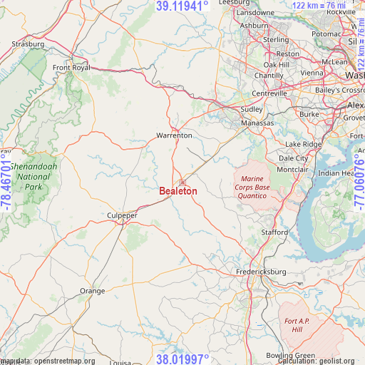
Bealeton GPS coordinates[2]
38° 34' 18.444" North, 77° 45' 49.968" West
| Map corner | latitude | longitude |
|---|---|---|
| Upper-left | 39.11941°, | -78.46701° |
| Center: | 38.57179°, | -77.76388° |
| Lower-right: | 38.01997°, | -77.06076° |
| Map W x H: | 122.2×122.2 km | = 75.9×75.9mi |
| max Lat: | 71.29058° ⇑58.3% North |
| Bealeton: | 38.57179° |
| min Lat: | ⇓41.7% South 19.06759° |
| min Long | Bealeton | max Long |
| -171.73463° | -77.76388° | -66.98998° |
| W 78.3%⇐ | ⇒21.7% E |
Elevation
Elevation of Bealeton is 88 m = 289 ft, and this is 206.8 m = 678 ft below average elevation for this country.
| Max E: |
3189 m = 10463 ft | 72.1% |
| Avg. | 294.8 m = 967 ft | |
| Bealeton | 88 m = 289 ft | |
Min E: |
-60 m = -197 ft | 27.9% |
See also: United States elevation on elevation.city.
Geographical zone
Bealeton is located in North temperate zone (between Tropic of Cancer and the Arctic Circle). Distance of this Northern Tropic circle is 1682.9 km =1045.7 mi to South.| Distance of | km | miles | from Bealeton |
|---|---|---|---|
| North Pole | 5718.3 | 3553.2 | to North |
| Arctic Circle | 3112.4 | 1934 | to North |
| Tropic Cancer | 1682.9 | 1045.7 | to South |
| Equator | 4288.8 | 2664.9 | to South |


Nearby cities:
15 places around Bealeton: (largest is in red/bold)
• Bull Run
31.6 km =19.6 mi,  41°
41°
• Culpeper
23 km =14.3 mi,  241°
241°
• Gainesville
28.1 km =17.5 mi,  27°
27°
• Haymarket
28.9 km =18 mi,  22°
22°
• Independent Hill
29.2 km =18.1 mi,  75°
75°
• Linton Hall
26.6 km =16.5 mi, 38°
• Manassas
32 km =19.9 mi,  51°
51°
• Marshall
33.6 km =20.9 mi,  345°
345°
• Merrimac
30.4 km =18.9 mi, 244°
• New Baltimore
22 km =13.7 mi,  8°
8°
• Nokesville
21.3 km =13.2 mi, 48°
• Opal
6.3 km =3.9 mi,  330°
330°
• Remington
5.7 km =3.5 mi,  222°
222°
• Warrenton
16 km =9.9 mi, 350°
• West Gate
32.9 km =20.4 mi, 44°
Sources, notices
• [Note1] Compared only with cities in United States existing in our database
• [Src1] Map data: © OpenStreetMap contributors (CC-BY-SA)
• [Src2] Other city data from geonames.org with taken over terms of usage.
• [Src3] Geographical zone / Annual Mean Temperature by Robert A. Rohde @ Wikipedia
