Belle Haven geodata
Belle Haven (Virginia) is a populated place; located in United States in America/New_York (GMT-4) time zone. With population of 525 people, there are 20573 cities with bigger population in this country. Compared to other cities in United States, 63.9% of cities are located further ↑North; 84.7% of cities are located further ←West and 92.1% of cities have higher elevation than Belle Haven. Note1


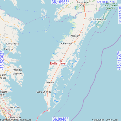
Belle Haven GPS coordinates[2]
37° 33' 15.48" North, 75° 49' 13.764" West
| Map corner | latitude | longitude |
|---|---|---|
| Upper-left | 38.10963°, | -76.52362° |
| Center: | 37.5543°, | -75.82049° |
| Lower-right: | 36.9948°, | -75.11737° |
| Map W x H: | 124×124 km | = 77.1×77.1mi |
| max Lat: | 71.29058° ⇑63.9% North |
| Belle Haven: | 37.5543° |
| min Lat: | ⇓36.1% South 19.06759° |
| min Long | Belle Haven | max Long |
| -171.73463° | -75.82049° | -66.98998° |
| W 84.7%⇐ | ⇒15.3% E |
Elevation
Elevation of Belle Haven is 12 m = 39 ft, and this is 282.8 m = 928 ft below average elevation for this country.
| Max E: |
3189 m = 10463 ft | 92.1% |
| Avg. | 294.8 m = 967 ft | |
| Belle Haven | 12 m = 39 ft | |
Min E: |
-60 m = -197 ft | 7.9% |
See also: United States elevation on elevation.city.
Geographical zone
Belle Haven is located in North temperate zone (between Tropic of Cancer and the Arctic Circle). Distance of this Northern Tropic circle is 1569.7 km =975.4 mi to South.| Distance of | km | miles | from Belle Haven |
|---|---|---|---|
| North Pole | 5831.4 | 3623.5 | to North |
| Arctic Circle | 3225.5 | 2004.2 | to North |
| Tropic Cancer | 1569.7 | 975.4 | to South |
| Equator | 4175.6 | 2594.6 | to South |


Nearby cities:
15 places around Belle Haven: (largest is in red/bold)
• Accomac
22.9 km =14.2 mi,  36°
36°
• Boston
6.4 km =4 mi,  342°
342°
• Cape Charles
36 km =22.4 mi,  208°
208°
• Deltaville
45.5 km =28.3 mi,  270°
270°
• Eastville
25 km =15.5 mi, 206°
• Exmore
2.5 km =1.6 mi,  185°
185°
• Gwynn
41.6 km =25.8 mi,  262°
262°
• Mathews
45.9 km =28.5 mi,  253°
253°
• Metompkin
30.6 km =19 mi, 38°
• Nelsonia
36 km =22.4 mi,  34°
34°
• Onancock
18.6 km =11.6 mi,  19°
19°
• Onley
17.8 km =11.1 mi, 31°
• Parksley
29.3 km =18.2 mi, 30°
• Pastoria
27.4 km =17 mi, 37°
• Tangier
33.8 km =21 mi,  333°
333°
Sources, notices
• [Note1] Compared only with cities in United States existing in our database
• [Src1] Map data: © OpenStreetMap contributors (CC-BY-SA)
• [Src2] Other city data from geonames.org with taken over terms of usage.
• [Src3] Geographical zone / Annual Mean Temperature by Robert A. Rohde @ Wikipedia
