Mathews geodata
Mathews (Virginia) is a seat of a second-order administrative division; located in United States in America/New_York (GMT-4) time zone. With population of 555 people, there are 20216 cities with bigger population in this country. Compared to other cities in United States, 64.3% of cities are located further ↑North; 83.1% of cities are located further ←West and 95.7% of cities have higher elevation than Mathews. Note1


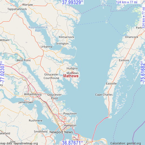
Mathews GPS coordinates[2]
37° 26' 13.488" North, 76° 19' 11.784" West
| Map corner | latitude | longitude |
|---|---|---|
| Upper-left | 37.99329°, | -77.02307° |
| Center: | 37.43708°, | -76.31994° |
| Lower-right: | 36.87671°, | -75.61682° |
| Map W x H: | 124.2×124.2 km | = 77.2×77.2mi |
| max Lat: | 71.29058° ⇑64.3% North |
| Mathews: | 37.43708° |
| min Lat: | ⇓35.7% South 19.06759° |
| min Long | Mathews | max Long |
| -171.73463° | -76.31994° | -66.98998° |
| W 83.1%⇐ | ⇒16.9% E |
Elevation
Elevation of Mathews is 8 m = 26 ft, and this is 286.8 m = 941 ft below average elevation for this country.
| Max E: |
3189 m = 10463 ft | 95.7% |
| Avg. | 294.8 m = 967 ft | |
| Mathews | 8 m = 26 ft | |
Min E: |
-60 m = -197 ft | 4.3% |
See also: United States elevation on elevation.city.
Geographical zone
Mathews is located in North temperate zone (between Tropic of Cancer and the Arctic Circle). Distance of this Northern Tropic circle is 1556.7 km =967.3 mi to South.| Distance of | km | miles | from Mathews |
|---|---|---|---|
| North Pole | 5844.4 | 3631.5 | to North |
| Arctic Circle | 3238.6 | 2012.4 | to North |
| Tropic Cancer | 1556.7 | 967.3 | to South |
| Equator | 4162.6 | 2586.5 | to South |


Nearby cities:
15 places around Mathews: (largest is in red/bold)
• Cape Charles
32.6 km =20.3 mi,  124°
124°
• Deltaville
13.2 km =8.2 mi,  353°
353°
• Eastville
34.4 km =21.4 mi,  105°
105°
• Gloucester Courthouse
18.5 km =11.5 mi,  260°
260°
• Gloucester Point
25.7 km =16 mi,  217°
217°
• Gwynn
8 km =5 mi,  20°
20°
• Kilmarnock
30.8 km =19.1 mi, 350°
• Lancaster
39.2 km =24.4 mi,  340°
340°
• Newport News
41.5 km =25.8 mi,  198°
198°
• Poquoson
35.1 km =21.8 mi,  183°
183°
• Saluda
30.7 km =19.1 mi,  307°
307°
• West Point
43.3 km =26.9 mi,  284°
284°
• Williamsburg
38.9 km =24.2 mi,  241°
241°
• Williamsburg
41.5 km =25.8 mi, 243°
• Yorktown
27.7 km =17.2 mi, 217°
Sources, notices
• [Note1] Compared only with cities in United States existing in our database
• [Src1] Map data: © OpenStreetMap contributors (CC-BY-SA)
• [Src2] Other city data from geonames.org with taken over terms of usage.
• [Src3] Geographical zone / Annual Mean Temperature by Robert A. Rohde @ Wikipedia
