Falmouth geodata
Falmouth (Virginia) is a populated place; located in United States in America/New_York (GMT-4) time zone. With population of 4,274 people, there are 7897 cities with bigger population in this country. Compared to other cities in United States, 59.8% of cities are located further ↑North; 79% of cities are located further ←West and 90% of cities have higher elevation than Falmouth. Note1


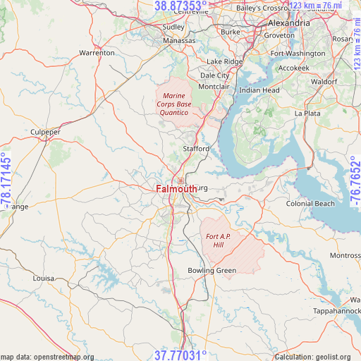
Falmouth GPS coordinates[2]
38° 19' 26.472" North, 77° 28' 5.952" West
| Map corner | latitude | longitude |
|---|---|---|
| Upper-left | 38.87353°, | -78.17145° |
| Center: | 38.32402°, | -77.46832° |
| Lower-right: | 37.77031°, | -76.7652° |
| Map W x H: | 122.7×122.7 km | = 76.2×76.2mi |
| max Lat: | 71.29058° ⇑59.8% North |
| Falmouth: | 38.32402° |
| min Lat: | ⇓40.2% South 19.06759° |
| min Long | Falmouth | max Long |
| -171.73463° | -77.46832° | -66.98998° |
| W 79%⇐ | ⇒21% E |
Elevation
Elevation of Falmouth is 16 m = 52 ft, and this is 278.8 m = 915 ft below average elevation for this country.
| Max E: |
3189 m = 10463 ft | 90% |
| Avg. | 294.8 m = 967 ft | |
| Falmouth | 16 m = 52 ft | |
Min E: |
-60 m = -197 ft | 10% |
See also: United States elevation on elevation.city.
Geographical zone
Falmouth is located in North temperate zone (between Tropic of Cancer and the Arctic Circle). Distance of this Northern Tropic circle is 1655.3 km =1028.6 mi to South.| Distance of | km | miles | from Falmouth |
|---|---|---|---|
| North Pole | 5745.8 | 3570.3 | to North |
| Arctic Circle | 3139.9 | 1951 | to North |
| Tropic Cancer | 1655.3 | 1028.6 | to South |
| Equator | 4261.2 | 2647.8 | to South |


Nearby cities:
15 places around Falmouth: (largest is in red/bold)
• Aquia Harbour
16.9 km =10.5 mi,  24°
24°
• Boswell's Corner
21.8 km =13.5 mi, 22°
• Bowling Green
32.3 km =20.1 mi,  160°
160°
• Cherry Hill
32.5 km =20.2 mi,  32°
32°
• Dumfries
29.7 km =18.5 mi, 24°
• Fredericksburg
2.4 km =1.5 mi, 163°
• King George
25.5 km =15.8 mi,  104°
104°
• Montclair
33.8 km =21 mi, 19°
• Passapatanzy
13.8 km =8.6 mi, 102°
• Quantico Station
25.7 km =16 mi, 30°
• Southern Gateway
3.9 km =2.4 mi,  307°
307°
• Spotsylvania
17.3 km =10.7 mi,  217°
217°
• Spotsylvania Courthouse
17.5 km =10.9 mi, 216°
• Stafford
12.1 km =7.5 mi, 25°
• Triangle
27.3 km =17 mi, 24°
Sources, notices
• [Note1] Compared only with cities in United States existing in our database
• [Src1] Map data: © OpenStreetMap contributors (CC-BY-SA)
• [Src2] Other city data from geonames.org with taken over terms of usage.
• [Src3] Geographical zone / Annual Mean Temperature by Robert A. Rohde @ Wikipedia
