Spotsylvania Courthouse geodata
Spotsylvania Courthouse (Virginia) is a populated place; located in United States in America/New_York (GMT-4) time zone. With population of 4,239 people, there are 7933 cities with bigger population in this country. Compared to other cities in United States, 60.7% of cities are located further ↑North; 78.7% of cities are located further ←West and 70.8% of cities have higher elevation than Spotsylvania Courthouse. Note1
Current local time in Spotsylvania Courthouse:
08:21 AM, FridayDifference from your time zone: hours


Spotsylvania Courthouse GPS coordinates[2]
38° 11' 52.476" North, 77° 35' 15.972" West
| Map corner | latitude | longitude |
|---|---|---|
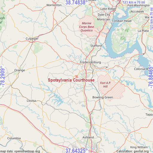
| Upper-left | 38.74838°, | -78.2909° |
| Center: | 38.19791°, | -77.58777° |
| Lower-right: | 37.64325°, | -76.88465° |
| Map W x H: | 122.9×122.9 km | = 76.4×76.4mi |
| max Lat: | 71.29058° ⇑60.7% North |
| Spotsylvania Courthouse: | 38.19791° |
| min Lat: | ⇓39.3% South 19.06759° |
| min Long | Spotsylvania Co | max Long |
| -171.73463° | -77.58777° | -66.98998° |
| W 78.7%⇐ | ⇒21.3% E |
Elevation
Elevation of Spotsylvania Courthouse is 96 m = 315 ft, and this is 198.8 m = 652 ft below average elevation for this country.
| Max E: |
3189 m = 10463 ft | 70.8% |
| Avg. | 294.8 m = 967 ft | |
| Spotsylvania Courthouse | 96 m = 315 ft | |
Min E: |
-60 m = -197 ft | 29.2% |
See also: United States elevation on elevation.city.
Geographical zone
Spotsylvania Courthouse is located in North temperate zone (between Tropic of Cancer and the Arctic Circle). Distance of this Northern Tropic circle is 1641.3 km =1019.9 mi to South.| Distance of | km | miles | from Spotsylvania Courthouse |
|---|---|---|---|
| North Pole | 5759.9 | 3579 | to North |
| Arctic Circle | 3154 | 1959.8 | to North |
| Tropic Cancer | 1641.3 | 1019.9 | to South |
| Equator | 4247.2 | 2639.1 | to South |


Nearby cities:
15 places around Spotsylvania Courthouse: (largest is in red/bold)
• Aquia Harbour
34.2 km =21.3 mi,  30°
30°
• Bealeton
44.3 km =27.5 mi,  339°
339°
• Blue Ridge Shores
39.6 km =24.6 mi,  254°
254°
• Boswell's Corner
39 km =24.2 mi, 28°
• Bowling Green
26.8 km =16.7 mi,  128°
128°
• Falmouth
17.5 km =10.9 mi,  36°
36°
• Fredericksburg
16.1 km =10 mi, 43°
• King George
36.1 km =22.4 mi,  77°
77°
• Louisa
41.2 km =25.6 mi,  242°
242°
• Passapatanzy
26.3 km =16.3 mi,  65°
65°
• Quantico Station
43.1 km =26.8 mi, 33°
• Remington
42 km =26.1 mi,  332°
332°
• Southern Gateway
17.9 km =11.1 mi,  24°
24°
• Spotsylvania
0.4 km =0.2 mi, 340°
• Stafford
29.4 km =18.3 mi, 32°
Sources, notices
• [Note1] Compared only with cities in United States existing in our database
• [Src1] Map data: © OpenStreetMap contributors (CC-BY-SA)
• [Src2] Other city data from geonames.org with taken over terms of usage.
• [Src3] Geographical zone / Annual Mean Temperature by Robert A. Rohde @ Wikipedia
