Hanover geodata
Hanover (Virginia) is a seat of a second-order administrative division; located in United States in America/New_York (GMT-4) time zone. With population of 252 people, there are 20991 cities with bigger population in this country. Compared to other cities in United States, 62.9% of cities are located further ↑North; 79.3% of cities are located further ←West and 82.3% of cities have higher elevation than Hanover. Note1


Hanover GPS coordinates[2]
37° 45' 59.508" North, 77° 22' 12.936" West
| Map corner | latitude | longitude |
|---|---|---|
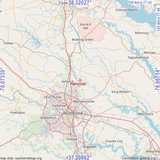
| Upper-left | 38.32027°, | -78.07339° |
| Center: | 37.76653°, | -77.37026° |
| Lower-right: | 37.20862°, | -76.66714° |
| Map W x H: | 123.6×123.6 km | = 76.8×76.8mi |
| max Lat: | 71.29058° ⇑62.9% North |
| Hanover: | 37.76653° |
| min Lat: | ⇓37.1% South 19.06759° |
| min Long | Hanover | max Long |
| -171.73463° | -77.37026° | -66.98998° |
| W 79.3%⇐ | ⇒20.7% E |
Elevation
Elevation of Hanover is 37 m = 121 ft, and this is 257.8 m = 846 ft below average elevation for this country.
| Max E: |
3189 m = 10463 ft | 82.3% |
| Avg. | 294.8 m = 967 ft | |
| Hanover | 37 m = 121 ft | |
Min E: |
-60 m = -197 ft | 17.7% |
See also: United States elevation on elevation.city.
Geographical zone
Hanover is located in North temperate zone (between Tropic of Cancer and the Arctic Circle). Distance of this Northern Tropic circle is 1593.3 km =990 mi to South.| Distance of | km | miles | from Hanover |
|---|---|---|---|
| North Pole | 5807.8 | 3608.8 | to North |
| Arctic Circle | 3201.9 | 1989.6 | to North |
| Tropic Cancer | 1593.3 | 990 | to South |
| Equator | 4199.2 | 2609.3 | to South |


Nearby cities:
15 places around Hanover: (largest is in red/bold)
• Ashland
9.7 km =6 mi,  265°
265°
• Central Garage
21.1 km =13.1 mi,  96°
96°
• Chamberlayne
16.4 km =10.2 mi,  198°
198°
• Dumbarton
21 km =13 mi,  210°
210°
• East Highland Park
20.9 km =13 mi,  188°
188°
• Glen Allen
16.4 km =10.2 mi,  226°
226°
• Highland Springs
24.8 km =15.4 mi,  171°
171°
• Lakeside
20 km =12.4 mi, 207°
• Laurel
18.4 km =11.4 mi,  221°
221°
• Laurel Park
17.8 km =11.1 mi, 219°
• Mechanicsville
17.5 km =10.9 mi,  180°
180°
• Richmond
24.9 km =15.5 mi, 198°
• Short Pump
24.9 km =15.5 mi,  238°
238°
• Tuckahoe
25.6 km =15.9 mi, 219°
• Wyndham
22.6 km =14 mi,  250°
250°
Sources, notices
• [Note1] Compared only with cities in United States existing in our database
• [Src1] Map data: © OpenStreetMap contributors (CC-BY-SA)
• [Src2] Other city data from geonames.org with taken over terms of usage.
• [Src3] Geographical zone / Annual Mean Temperature by Robert A. Rohde @ Wikipedia
