Huntington geodata
Huntington (Virginia) is a populated place; located in United States in America/New_York (GMT-4) time zone. With population of 11,267 people, there are 4097 cities with bigger population in this country. Compared to other cities in United States, 56.6% of cities are located further ↑North; 80.3% of cities are located further ←West and 89.1% of cities have higher elevation than Huntington. Note1


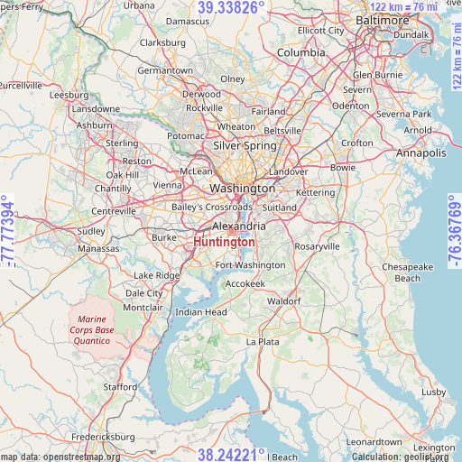
Huntington GPS coordinates[2]
38° 47' 32.424" North, 77° 4' 14.916" West
| Map corner | latitude | longitude |
|---|---|---|
| Upper-left | 39.33826°, | -77.77394° |
| Center: | 38.79234°, | -77.07081° |
| Lower-right: | 38.24221°, | -76.36769° |
| Map W x H: | 121.9×121.9 km | = 75.7×75.7mi |
| max Lat: | 71.29058° ⇑56.6% North |
| Huntington: | 38.79234° |
| min Lat: | ⇓43.4% South 19.06759° |
| min Long | Huntington | max Long |
| -171.73463° | -77.07081° | -66.98998° |
| W 80.3%⇐ | ⇒19.7% E |
Elevation
Elevation of Huntington is 18 m = 59 ft, and this is 276.8 m = 908 ft below average elevation for this country.
| Max E: |
3189 m = 10463 ft | 89.1% |
| Avg. | 294.8 m = 967 ft | |
| Huntington | 18 m = 59 ft | |
Min E: |
-60 m = -197 ft | 10.9% |
See also: United States elevation on elevation.city.
Geographical zone
Huntington is located in North temperate zone (between Tropic of Cancer and the Arctic Circle). Distance of this Northern Tropic circle is 1707.4 km =1060.9 mi to South.| Distance of | km | miles | from Huntington |
|---|---|---|---|
| North Pole | 5693.8 | 3538 | to North |
| Arctic Circle | 3087.9 | 1918.7 | to North |
| Tropic Cancer | 1707.4 | 1060.9 | to South |
| Equator | 4313.3 | 2680.2 | to South |


Nearby cities:
15 places around Huntington: (largest is in red/bold)
• Alexandria
2.5 km =1.6 mi,  56°
56°
• Baileys Crossroads
8.2 km =5.1 mi,  321°
321°
• Belle Haven
1 km =0.6 mi,  138°
138°
• Forest Heights
6.6 km =4.1 mi,  73°
73°
• Fort Hunt
6.7 km =4.2 mi,  170°
170°
• Franconia
6.6 km =4.1 mi,  260°
260°
• Glassmanor
6.9 km =4.3 mi, 64°
• Groveton
3 km =1.9 mi,  203°
203°
• Hayfield
7.2 km =4.5 mi,  231°
231°
• Hybla Valley
5.1 km =3.2 mi,  192°
192°
• Lincolnia
6.9 km =4.3 mi,  294°
294°
• National Harbor
5 km =3.1 mi,  102°
102°
• Oxon Hill
7.1 km =4.4 mi,  80°
80°
• Oxon Hill-Glassmanor
8.3 km =5.2 mi,  87°
87°
• Rose Hill
3.7 km =2.3 mi, 263°
Sources, notices
• [Note1] Compared only with cities in United States existing in our database
• [Src1] Map data: © OpenStreetMap contributors (CC-BY-SA)
• [Src2] Other city data from geonames.org with taken over terms of usage.
• [Src3] Geographical zone / Annual Mean Temperature by Robert A. Rohde @ Wikipedia
