Stuart geodata
Stuart (Virginia) is a seat of a second-order administrative division; located in United States in America/New_York (GMT-4) time zone. With population of 1,442 people, there are 13907 cities with bigger population in this country. Compared to other cities in United States, 67.6% of cities are located further ↑North; 71.8% of cities are located further ←West and 84.2% of cities have lower elevation than Stuart. Note1


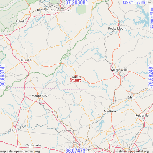
Stuart GPS coordinates[2]
36° 38' 27.492" North, 80° 15' 56.196" West
| Map corner | latitude | longitude |
|---|---|---|
| Upper-left | 37.20308°, | -80.96874° |
| Center: | 36.64097°, | -80.26561° |
| Lower-right: | 36.07473°, | -79.56249° |
| Map W x H: | 125.5×125.5 km | = 78×78mi |
| max Lat: | 71.29058° ⇑67.6% North |
| Stuart: | 36.64097° |
| min Lat: | ⇓32.4% South 19.06759° |
| min Long | Stuart | max Long |
| -171.73463° | -80.26561° | -66.98998° |
| W 71.8%⇐ | ⇒28.2% E |
Elevation
Elevation of Stuart is 408 m = 1339 ft, and this is 113.2 m = 371 ft above average elevation for this country.
| Max E: |
3189 m = 10463 ft | 15.8% |
| Stuart | 408 m 1339 ft | |
| Avg. | 294.8 m = 967 ft | |
Min E: |
-60 m = -197 ft | 84.2% |
See also: United States elevation on elevation.city.
Geographical zone
Stuart is located in North temperate zone (between Tropic of Cancer and the Arctic Circle). Distance of this Northern Tropic circle is 1468.2 km =912.3 mi to South.| Distance of | km | miles | from Stuart |
|---|---|---|---|
| North Pole | 5933 | 3686.6 | to North |
| Arctic Circle | 3327.1 | 2067.4 | to North |
| Tropic Cancer | 1468.2 | 912.3 | to South |
| Equator | 4074.1 | 2531.5 | to South |


Nearby cities:
15 places around Stuart: (largest is in red/bold)
• Bassett
27.8 km =17.3 mi,  61°
61°
• Collinsville
32.3 km =20.1 mi,  75°
75°
• Danbury
26.3 km =16.3 mi,  168°
168°
• Fieldale
29.9 km =18.6 mi, 77°
• Flat Rock
30.7 km =19.1 mi,  242°
242°
• Floyd
30.4 km =18.9 mi,  350°
350°
• Horse Pasture
28.1 km =17.5 mi,  92°
92°
• Martinsville
35.5 km =22.1 mi, 80°
• Mount Airy
34.3 km =21.3 mi, 242°
• Oak Level
35.2 km =21.9 mi, 56°
• Pannill Fork
23.8 km =14.8 mi,  71°
71°
• Patrick Springs
6.3 km =3.9 mi, 89°
• Pilot Mountain
33.7 km =20.9 mi,  212°
212°
• Stanleytown
29.3 km =18.2 mi, 66°
• Villa Heights
32.9 km =20.4 mi, 79°
Sources, notices
• [Note1] Compared only with cities in United States existing in our database
• [Src1] Map data: © OpenStreetMap contributors (CC-BY-SA)
• [Src2] Other city data from geonames.org with taken over terms of usage.
• [Src3] Geographical zone / Annual Mean Temperature by Robert A. Rohde @ Wikipedia
