Red Jacket geodata
Red Jacket (West Virginia) is a populated place; located in United States in America/New_York (GMT-4) time zone. With population of 581 people, there are 19902 cities with bigger population in this country. Compared to other cities in United States, 63.5% of cities are located further ↑North; 65.1% of cities are located further ←West and 59.9% of cities have lower elevation than Red Jacket. Note1


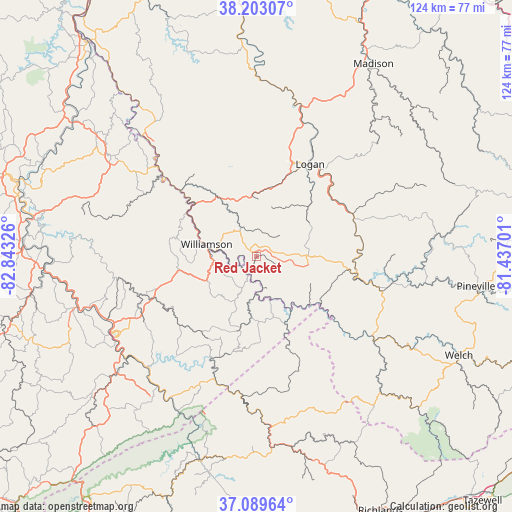
Red Jacket GPS coordinates[2]
37° 38' 54.384" North, 82° 8' 24.468" West
| Map corner | latitude | longitude |
|---|---|---|
| Upper-left | 38.20307°, | -82.84326° |
| Center: | 37.64844°, | -82.14013° |
| Lower-right: | 37.08964°, | -81.43701° |
| Map W x H: | 123.8×123.8 km | = 76.9×76.9mi |
| max Lat: | 71.29058° ⇑63.5% North |
| Red Jacket: | 37.64844° |
| min Lat: | ⇓36.5% South 19.06759° |
| min Long | Red Jacket | max Long |
| -171.73463° | -82.14013° | -66.98998° |
| W 65.1%⇐ | ⇒34.9% E |
Elevation
Elevation of Red Jacket is 239 m = 784 ft, and this is 55.8 m = 183 ft below average elevation for this country.
| Max E: |
3189 m = 10463 ft | 40.1% |
| Avg. | 294.8 m = 967 ft | |
| Red Jacket | 239 m = 784 ft | |
Min E: |
-60 m = -197 ft | 59.9% |
See also: United States elevation on elevation.city.
Geographical zone
Red Jacket is located in North temperate zone (between Tropic of Cancer and the Arctic Circle). Distance of this Northern Tropic circle is 1580.2 km =981.9 mi to South.| Distance of | km | miles | from Red Jacket |
|---|---|---|---|
| North Pole | 5820.9 | 3616.9 | to North |
| Arctic Circle | 3215.1 | 1997.8 | to North |
| Tropic Cancer | 1580.2 | 981.9 | to South |
| Equator | 4186.1 | 2601.1 | to South |


Nearby cities:
15 places around Red Jacket: (largest is in red/bold)
• Bruno
24.3 km =15.1 mi,  78°
78°
• Chattaroy
13.8 km =8.6 mi,  296°
296°
• Delbarton
7.9 km =4.9 mi,  330°
330°
• Gilbert Creek
23.1 km =14.4 mi,  110°
110°
• Holden
20.8 km =12.9 mi,  19°
19°
• Logan
25.7 km =16 mi,  30°
30°
• Man
25.2 km =15.7 mi,  66°
66°
• McConnell
24.9 km =15.5 mi,  37°
37°
• Mount Gay-Shamrock
23.3 km =14.5 mi, 24°
• Omar
17.2 km =10.7 mi,  46°
46°
• Phelps
15.1 km =9.4 mi,  183°
183°
• South Williamson
12.9 km =8 mi,  281°
281°
• Switzer
20.9 km =13 mi, 39°
• Verdunville
23.1 km =14.4 mi, 18°
• Williamson
12.4 km =7.7 mi, 283°
Sources, notices
• [Note1] Compared only with cities in United States existing in our database
• [Src1] Map data: © OpenStreetMap contributors (CC-BY-SA)
• [Src2] Other city data from geonames.org with taken over terms of usage.
• [Src3] Geographical zone / Annual Mean Temperature by Robert A. Rohde @ Wikipedia
