Verdunville geodata
Verdunville (West Virginia) is a populated place; located in United States in America/New_York (GMT-4) time zone. With population of 687 people, there are 18811 cities with bigger population in this country. Compared to other cities in United States, 62.4% of cities are located further ↑North; 65.3% of cities are located further ←West and 75.1% of cities have lower elevation than Verdunville. Note1


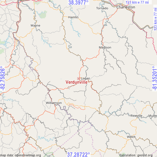
Verdunville GPS coordinates[2]
37° 50' 40.38" North, 82° 3' 18.468" West
| Map corner | latitude | longitude |
|---|---|---|
| Upper-left | 38.3977°, | -82.75826° |
| Center: | 37.84455°, | -82.05513° |
| Lower-right: | 37.28722°, | -81.35201° |
| Map W x H: | 123.5×123.5 km | = 76.7×76.7mi |
| max Lat: | 71.29058° ⇑62.4% North |
| Verdunville: | 37.84455° |
| min Lat: | ⇓37.6% South 19.06759° |
| min Long | Verdunville | max Long |
| -171.73463° | -82.05513° | -66.98998° |
| W 65.3%⇐ | ⇒34.7% E |
Elevation
Elevation of Verdunville is 314 m = 1030 ft, and this is 19.2 m = 63 ft above average elevation for this country.
| Max E: |
3189 m = 10463 ft | 24.9% |
| Verdunville | 314 m 1030 ft | |
| Avg. | 294.8 m = 967 ft | |
Min E: |
-60 m = -197 ft | 75.1% |
See also: United States elevation on elevation.city.
Geographical zone
Verdunville is located in North temperate zone (between Tropic of Cancer and the Arctic Circle). Distance of this Northern Tropic circle is 1602 km =995.4 mi to South.| Distance of | km | miles | from Verdunville |
|---|---|---|---|
| North Pole | 5799.1 | 3603.4 | to North |
| Arctic Circle | 3193.3 | 1984.2 | to North |
| Tropic Cancer | 1602 | 995.4 | to South |
| Equator | 4207.9 | 2614.7 | to South |


Nearby cities:
15 places around Verdunville: (largest is in red/bold)
• Accoville
20.9 km =13 mi,  113°
113°
• Bruno
23.7 km =14.7 mi,  136°
136°
• Chapmanville
14.7 km =9.1 mi,  12°
12°
• Delbarton
18.7 km =11.6 mi,  217°
217°
• Harts
21.7 km =13.5 mi,  342°
342°
• Holden
2.3 km =1.4 mi,  189°
189°
• Kistler
19.7 km =12.2 mi,  119°
119°
• Logan
5.4 km =3.4 mi,  85°
85°
• Mallory
22.9 km =14.2 mi, 123°
• Man
19.5 km =12.1 mi,  126°
126°
• McConnell
8 km =5 mi, 105°
• Mount Gay-Shamrock
2.3 km =1.4 mi, 106°
• Omar
11 km =6.8 mi,  153°
153°
• Red Jacket
23.1 km =14.4 mi,  198°
198°
• Switzer
8.2 km =5.1 mi, 133°
Sources, notices
• [Note1] Compared only with cities in United States existing in our database
• [Src1] Map data: © OpenStreetMap contributors (CC-BY-SA)
• [Src2] Other city data from geonames.org with taken over terms of usage.
• [Src3] Geographical zone / Annual Mean Temperature by Robert A. Rohde @ Wikipedia
