Lena geodata
Lena (Illinois) is a populated place; located in United States in America/Chicago (GMT-5) time zone. With population of 2,800 people, there are 9990 cities with bigger population in this country. Compared to other cities in United States, 78.8% of cities are located further ↓South; 58.5% of cities are located further →East and 71.5% of cities have lower elevation than Lena. Note1
Administrative division(s):
- Level 1: Illinois
- Level 2: Stephenson County
- Level 3: Township of West Point


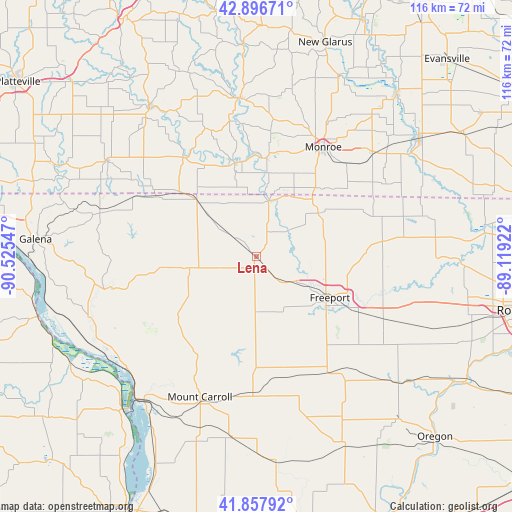
Lena GPS coordinates[2]
42° 22' 46.056" North, 89° 49' 20.424" West
| Map corner | latitude | longitude |
|---|---|---|
| Upper-left | 42.89671°, | -90.52547° |
| Center: | 42.37946°, | -89.82234° |
| Lower-right: | 41.85792°, | -89.11922° |
| Map W x H: | 115.5×115.5 km | = 71.8×71.8mi |
| max Lat: | 71.29058° ⇑21.2% North |
| Lena: | 42.37946° |
| min Lat: | ⇓78.8% South 19.06759° |
| min Long | Lena | max Long |
| -171.73463° | -89.82234° | -66.98998° |
| W 41.5%⇐ | ⇒58.5% E |
Elevation
Elevation of Lena is 293 m = 961 ft, and this is 1.8 m = 6 ft below average elevation for this country.
| Max E: |
3189 m = 10463 ft | 28.5% |
| Avg. | 294.8 m = 967 ft | |
| Lena | 293 m = 961 ft | |
Min E: |
-60 m = -197 ft | 71.5% |
See also: United States elevation on elevation.city.
Geographical zone
Lena is located in North temperate zone (between Tropic of Cancer and the Arctic Circle). Distance of this Northern Tropic circle is 2106.2 km =1308.7 mi to South.| Distance of | km | miles | from Lena |
|---|---|---|---|
| North Pole | 5294.9 | 3290.1 | to North |
| Arctic Circle | 2689 | 1670.9 | to North |
| Tropic Cancer | 2106.2 | 1308.7 | to South |
| Equator | 4712.2 | 2928 | to South |


Nearby cities:
15 places around Lena: (largest is in red/bold)
• Apple Canyon Lake
27.8 km =17.3 mi,  279°
279°
• Cedarville
15.5 km =9.6 mi,  91°
91°
• Davis
33.9 km =21.1 mi,  81°
81°
• Elizabeth
33.5 km =20.8 mi,  258°
258°
• Forreston
34.5 km =21.4 mi,  144°
144°
• Freeport
18.9 km =11.7 mi,  119°
119°
• Georgetown
26.7 km =16.6 mi,  181°
181°
• Lanark
30.8 km =19.1 mi, 181°
• Monroe
28.9 km =18 mi,  31°
31°
• Mount Carroll
34.1 km =21.2 mi,  202°
202°
• Orangeville
17.7 km =11 mi,  55°
55°
• Pearl City
12.7 km =7.9 mi, 181°
• Shannon
25.9 km =16.1 mi,  164°
164°
• Stockton
15.5 km =9.6 mi, 257°
• Warren
18.9 km =11.7 mi,  313°
313°
Sources, notices
• [Note1] Compared only with cities in United States existing in our database
• [Src1] Map data: © OpenStreetMap contributors (CC-BY-SA)
• [Src2] Other city data from geonames.org with taken over terms of usage.
• [Src3] Geographical zone / Annual Mean Temperature by Robert A. Rohde @ Wikipedia
