La Porte City geodata
La Porte City (Iowa) is a populated place; located in United States in America/Chicago (GMT-5) time zone. With population of 2,290 people, there are 11105 cities with bigger population in this country. Compared to other cities in United States, 78.2% of cities are located further ↓South; 64.6% of cities are located further →East and 63.1% of cities have lower elevation than La Porte City. Note1


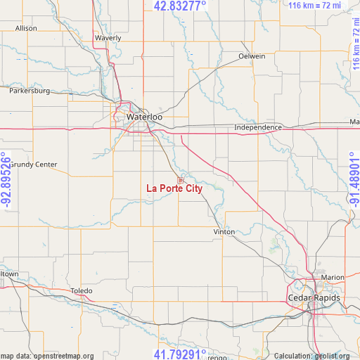
La Porte City GPS coordinates[2]
42° 18' 53.964" North, 92° 11' 31.668" West
| Map corner | latitude | longitude |
|---|---|---|
| Upper-left | 42.83277°, | -92.89526° |
| Center: | 42.31499°, | -92.19213° |
| Lower-right: | 41.79291°, | -91.48901° |
| Map W x H: | 115.6×115.6 km | = 71.8×71.8mi |
| max Lat: | 71.29058° ⇑21.8% North |
| La Porte City: | 42.31499° |
| min Lat: | ⇓78.2% South 19.06759° |
| min Long | La Porte City | max Long |
| -171.73463° | -92.19213° | -66.98998° |
| W 35.4%⇐ | ⇒64.6% E |
Elevation
Elevation of La Porte City is 253 m = 830 ft, and this is 41.8 m = 137 ft below average elevation for this country.
| Max E: |
3189 m = 10463 ft | 36.9% |
| Avg. | 294.8 m = 967 ft | |
| La Porte City | 253 m = 830 ft | |
Min E: |
-60 m = -197 ft | 63.1% |
See also: United States elevation on elevation.city.
Geographical zone
La Porte City is located in North temperate zone (between Tropic of Cancer and the Arctic Circle). Distance of this Northern Tropic circle is 2099.1 km =1304.3 mi to South.| Distance of | km | miles | from La Porte City |
|---|---|---|---|
| North Pole | 5302.1 | 3294.6 | to North |
| Arctic Circle | 2696.2 | 1675.3 | to North |
| Tropic Cancer | 2099.1 | 1304.3 | to South |
| Equator | 4705 | 2923.6 | to South |


Nearby cities:
15 places around La Porte City: (largest is in red/bold)
• Cedar Falls
31.5 km =19.6 mi,  318°
318°
• Dunkerton
28.5 km =17.7 mi,  5°
5°
• Dysart
18.5 km =11.5 mi,  210°
210°
• Elk Run Heights
17.7 km =11 mi,  342°
342°
• Evansdale
18.6 km =11.6 mi, 336°
• Gilbertville
11.4 km =7.1 mi,  350°
350°
• Hudson
23.9 km =14.9 mi,  295°
295°
• Independence
30.2 km =18.8 mi,  55°
55°
• Jesup
20.7 km =12.9 mi,  30°
30°
• Raymond
17.3 km =10.7 mi, 352°
• Traer
26.2 km =16.3 mi,  239°
239°
• Urbana
28 km =17.4 mi,  111°
111°
• Vinton
21.4 km =13.3 mi,  139°
139°
• Washburn
12.4 km =7.7 mi,  330°
330°
• Waterloo
23.3 km =14.5 mi, 327°
Sources, notices
• [Note1] Compared only with cities in United States existing in our database
• [Src1] Map data: © OpenStreetMap contributors (CC-BY-SA)
• [Src2] Other city data from geonames.org with taken over terms of usage.
• [Src3] Geographical zone / Annual Mean Temperature by Robert A. Rohde @ Wikipedia
