Champaign geodata
Champaign (Illinois) is a populated place; located in United States in America/Chicago (GMT-5) time zone. With population of 86,096 people, there are 448 cities with bigger population in this country. Compared to other cities in United States, 54.7% of cities are located further ↓South; 53.9% of cities are located further →East and 57.5% of cities have lower elevation than Champaign. Note1
Administrative division(s):
- Level 1: Illinois
- Level 2: Champaign County
- Level 3: Township of Champaign City


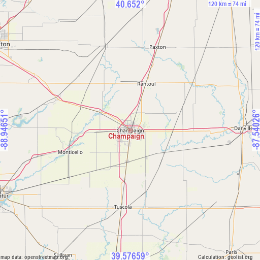
Champaign GPS coordinates[2]
40° 6' 59.112" North, 88° 14' 36.168" West
| Map corner | latitude | longitude |
|---|---|---|
| Upper-left | 40.652°, | -88.94651° |
| Center: | 40.11642°, | -88.24338° |
| Lower-right: | 39.57659°, | -87.54026° |
| Map W x H: | 119.6×119.6 km | = 74.3×74.3mi |
| max Lat: | 71.29058° ⇑45.3% North |
| Champaign: | 40.11642° |
| min Lat: | ⇓54.7% South 19.06759° |
| min Long | Champaign | max Long |
| -171.73463° | -88.24338° | -66.98998° |
| W 46.1%⇐ | ⇒53.9% E |
Elevation
Elevation of Champaign is 228 m = 748 ft, and this is 66.8 m = 219 ft below average elevation for this country.
| Max E: |
3189 m = 10463 ft | 42.5% |
| Avg. | 294.8 m = 967 ft | |
| Champaign | 228 m = 748 ft | |
Min E: |
-60 m = -197 ft | 57.5% |
See also: Champaign elevation on elevation.city.
Geographical zone
Champaign is located in North temperate zone (between Tropic of Cancer and the Arctic Circle). Distance of this Northern Tropic circle is 1854.6 km =1152.4 mi to South.| Distance of | km | miles | from Champaign |
|---|---|---|---|
| North Pole | 5546.5 | 3446.4 | to North |
| Arctic Circle | 2940.6 | 1827.2 | to North |
| Tropic Cancer | 1854.6 | 1152.4 | to South |
| Equator | 4460.5 | 2771.6 | to South |


Nearby cities:
15 places around Champaign: (largest is in red/bold)
• Fisher
23.8 km =14.8 mi,  337°
337°
• Homer
25.9 km =16.1 mi,  110°
110°
• Lake of the Woods
14.6 km =9.1 mi,  313°
313°
• Mahomet
16.2 km =10.1 mi,  302°
302°
• Mansfield
24.7 km =15.3 mi, 295°
• Ogden
24.4 km =15.2 mi,  90°
90°
• Pesotum
22.6 km =14 mi,  186°
186°
• Philo
14.2 km =8.8 mi,  149°
149°
• Rantoul
22.6 km =14 mi,  19°
19°
• Saint Joseph
17.2 km =10.7 mi, 91°
• Savoy
6.9 km =4.3 mi, 185°
• Sidney
17.7 km =11 mi,  125°
125°
• Thomasboro
14.8 km =9.2 mi, 19°
• Tolono
14.5 km =9 mi, 185°
• Urbana
3.1 km =1.9 mi,  101°
101°
Sources, notices
• [Note1] Compared only with cities in United States existing in our database
• [Src1] Map data: © OpenStreetMap contributors (CC-BY-SA)
• [Src2] Other city data from geonames.org with taken over terms of usage.
• [Src3] Geographical zone / Annual Mean Temperature by Robert A. Rohde @ Wikipedia
