Cheshire geodata
Cheshire (Massachusetts) is a populated place; located in United States in America/New_York (GMT-4) time zone. With population of 514 people, there are 20706 cities with bigger population in this country. Compared to other cities in United States, 80.3% of cities are located further ↓South; 93.5% of cities are located further ←West and 72.9% of cities have lower elevation than Cheshire. Note1
Administrative division(s):
- Level 1: Massachusetts
- Level 2: Berkshire County
- Level 3: Town of Cheshire


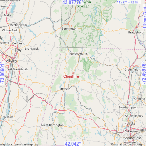
Cheshire GPS coordinates[2]
42° 33' 43.308" North, 73° 9' 46.368" West
| Map corner | latitude | longitude |
|---|---|---|
| Upper-left | 43.07776°, | -73.86601° |
| Center: | 42.56203°, | -73.16288° |
| Lower-right: | 42.042°, | -72.45976° |
| Map W x H: | 115.2×115.2 km | = 71.6×71.6mi |
| max Lat: | 71.29058° ⇑19.7% North |
| Cheshire: | 42.56203° |
| min Lat: | ⇓80.3% South 19.06759° |
| min Long | Cheshire | max Long |
| -171.73463° | -73.16288° | -66.98998° |
| W 93.5%⇐ | ⇒6.5% E |
Elevation
Elevation of Cheshire is 301 m = 988 ft, and this is 6.2 m = 20 ft above average elevation for this country.
| Max E: |
3189 m = 10463 ft | 27.1% |
| Cheshire | 301 m 988 ft | |
| Avg. | 294.8 m = 967 ft | |
Min E: |
-60 m = -197 ft | 72.9% |
See also: United States elevation on elevation.city.
Geographical zone
Cheshire is located in North temperate zone (between Tropic of Cancer and the Arctic Circle). Distance of this Northern Tropic circle is 2126.5 km =1321.3 mi to South.| Distance of | km | miles | from Cheshire |
|---|---|---|---|
| North Pole | 5274.6 | 3277.5 | to North |
| Arctic Circle | 2668.7 | 1658.3 | to North |
| Tropic Cancer | 2126.5 | 1321.3 | to South |
| Equator | 4732.5 | 2940.6 | to South |


Nearby cities:
15 places around Cheshire: (largest is in red/bold)
• Adams
7.8 km =4.8 mi,  28°
28°
• Cummington
24.7 km =15.3 mi,  116°
116°
• Dalton
9.8 km =6.1 mi,  181°
181°
• Florida
17 km =10.6 mi,  46°
46°
• Hancock
13.3 km =8.3 mi,  260°
260°
• Hinsdale
14.1 km =8.8 mi,  167°
167°
• Lanesborough
7.3 km =4.5 mi,  227°
227°
• North Adams
16.1 km =10 mi,  16°
16°
• Peru
16.8 km =10.4 mi,  145°
145°
• Pittsfield
14.2 km =8.8 mi,  208°
208°
• Pownal
23.4 km =14.5 mi,  345°
345°
• Savoy
11 km =6.8 mi,  87°
87°
• Washington
22.1 km =13.7 mi, 170°
• Williamstown
17 km =10.6 mi, 348°
• Windsor
10.3 km =6.4 mi, 123°
Sources, notices
• [Note1] Compared only with cities in United States existing in our database
• [Src1] Map data: © OpenStreetMap contributors (CC-BY-SA)
• [Src2] Other city data from geonames.org with taken over terms of usage.
• [Src3] Geographical zone / Annual Mean Temperature by Robert A. Rohde @ Wikipedia
