Pittsfield geodata
Pittsfield (Massachusetts) is a populated place; located in United States in America/New_York (GMT-4) time zone. With population of 43,303 people, there are 1102 cities with bigger population in this country. Compared to other cities in United States, 79.3% of cities are located further ↓South; 93.3% of cities are located further ←West and 73.5% of cities have lower elevation than Pittsfield. Note1
Administrative division(s):
- Level 1: Massachusetts
- Level 2: Berkshire County
- Level 3: City of Pittsfield


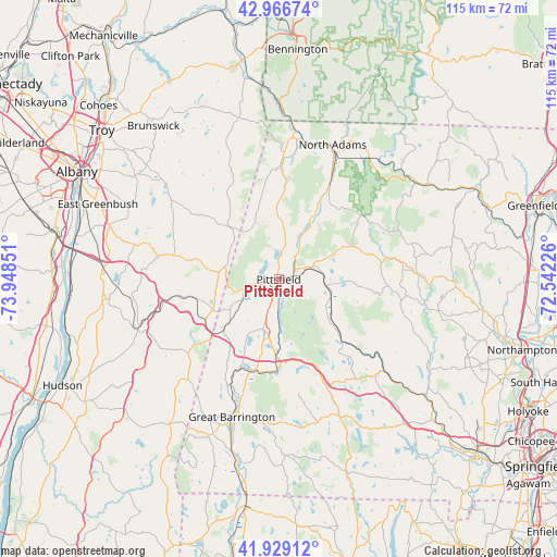
Pittsfield GPS coordinates[2]
42° 27' 0.288" North, 73° 14' 43.368" West
| Map corner | latitude | longitude |
|---|---|---|
| Upper-left | 42.96674°, | -73.94851° |
| Center: | 42.45008°, | -73.24538° |
| Lower-right: | 41.92912°, | -72.54226° |
| Map W x H: | 115.4×115.4 km | = 71.7×71.7mi |
| max Lat: | 71.29058° ⇑20.7% North |
| Pittsfield: | 42.45008° |
| min Lat: | ⇓79.3% South 19.06759° |
| min Long | Pittsfield | max Long |
| -171.73463° | -73.24538° | -66.98998° |
| W 93.3%⇐ | ⇒6.7% E |
Elevation
Elevation of Pittsfield is 304 m = 997 ft, and this is 9.2 m = 30 ft above average elevation for this country.
| Max E: |
3189 m = 10463 ft | 26.5% |
| Pittsfield | 304 m 997 ft | |
| Avg. | 294.8 m = 967 ft | |
Min E: |
-60 m = -197 ft | 73.5% |
See also: Pittsfield elevation on elevation.city.
Geographical zone
Pittsfield is located in North temperate zone (between Tropic of Cancer and the Arctic Circle). Distance of this Northern Tropic circle is 2114.1 km =1313.6 mi to South.| Distance of | km | miles | from Pittsfield |
|---|---|---|---|
| North Pole | 5287.1 | 3285.3 | to North |
| Arctic Circle | 2681.2 | 1666 | to North |
| Tropic Cancer | 2114.1 | 1313.6 | to South |
| Equator | 4720 | 2932.9 | to South |


Nearby cities:
15 places around Pittsfield: (largest is in red/bold)
• Adams
22 km =13.7 mi,  28°
28°
• Becket
18.7 km =11.6 mi,  134°
134°
• Cheshire
14.2 km =8.8 mi, 28°
• Dalton
7 km =4.3 mi,  67°
67°
• Hancock
12.2 km =7.6 mi,  328°
328°
• Hinsdale
9.9 km =6.2 mi,  97°
97°
• Lanesborough
7.6 km =4.7 mi,  10°
10°
• Lee
16.2 km =10.1 mi,  180°
180°
• Lenox
10.9 km =6.8 mi,  197°
197°
• Peru
16.4 km =10.2 mi,  94°
94°
• Richmond
13.2 km =8.2 mi,  229°
229°
• Stockbridge
19.1 km =11.9 mi, 198°
• Washington
14.1 km =8.8 mi, 131°
• West Stockbridge
15.3 km =9.5 mi,  220°
220°
• Windsor
16.8 km =10.4 mi, 65°
Sources, notices
• [Note1] Compared only with cities in United States existing in our database
• [Src1] Map data: © OpenStreetMap contributors (CC-BY-SA)
• [Src2] Other city data from geonames.org with taken over terms of usage.
• [Src3] Geographical zone / Annual Mean Temperature by Robert A. Rohde @ Wikipedia
