Lanesborough geodata
Lanesborough (Massachusetts) is a populated place; located in United States in America/New_York (GMT-4) time zone. With population of 3,042 people, there are 9563 cities with bigger population in this country. Compared to other cities in United States, 79.9% of cities are located further ↓South; 93.4% of cities are located further ←West and 79.2% of cities have lower elevation than Lanesborough. Note1
Administrative division(s):
- Level 1: Massachusetts
- Level 2: Berkshire County
- Level 3: Town of Lanesborough


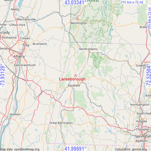
Lanesborough GPS coordinates[2]
42° 31' 2.316" North, 73° 13' 41.376" West
| Map corner | latitude | longitude |
|---|---|---|
| Upper-left | 43.03341°, | -73.93129° |
| Center: | 42.51731°, | -73.22816° |
| Lower-right: | 41.99691°, | -72.52504° |
| Map W x H: | 115.2×115.2 km | = 71.6×71.6mi |
| max Lat: | 71.29058° ⇑20.1% North |
| Lanesborough: | 42.51731° |
| min Lat: | ⇓79.9% South 19.06759° |
| min Long | Lanesborough | max Long |
| -171.73463° | -73.22816° | -66.98998° |
| W 93.4%⇐ | ⇒6.6% E |
Elevation
Elevation of Lanesborough is 346 m = 1135 ft, and this is 51.2 m = 168 ft above average elevation for this country.
| Max E: |
3189 m = 10463 ft | 20.8% |
| Lanesborough | 346 m 1135 ft | |
| Avg. | 294.8 m = 967 ft | |
Min E: |
-60 m = -197 ft | 79.2% |
See also: United States elevation on elevation.city.
Geographical zone
Lanesborough is located in North temperate zone (between Tropic of Cancer and the Arctic Circle). Distance of this Northern Tropic circle is 2121.6 km =1318.3 mi to South.| Distance of | km | miles | from Lanesborough |
|---|---|---|---|
| North Pole | 5279.6 | 3280.6 | to North |
| Arctic Circle | 2673.7 | 1661.4 | to North |
| Tropic Cancer | 2121.6 | 1318.3 | to South |
| Equator | 4727.5 | 2937.5 | to South |


Nearby cities:
15 places around Lanesborough: (largest is in red/bold)
• Adams
14.9 km =9.3 mi,  37°
37°
• Cheshire
7.3 km =4.5 mi,  47°
47°
• Dalton
7 km =4.3 mi,  133°
133°
• Hancock
8.3 km =5.2 mi,  290°
290°
• Hinsdale
12.1 km =7.5 mi,  136°
136°
• Lenox
18.5 km =11.5 mi,  194°
194°
• North Adams
22.6 km =14 mi,  25°
25°
• Peru
17.3 km =10.7 mi,  120°
120°
• Pittsfield
7.6 km =4.7 mi, 190°
• Richmond
19.7 km =12.2 mi,  215°
215°
• Savoy
17.2 km =10.7 mi,  71°
71°
• Washington
19.2 km =11.9 mi,  151°
151°
• West Stockbridge
22.2 km =13.8 mi,  210°
210°
• Williamstown
21.7 km =13.5 mi,  5°
5°
• Windsor
14 km =8.7 mi,  92°
92°
Sources, notices
• [Note1] Compared only with cities in United States existing in our database
• [Src1] Map data: © OpenStreetMap contributors (CC-BY-SA)
• [Src2] Other city data from geonames.org with taken over terms of usage.
• [Src3] Geographical zone / Annual Mean Temperature by Robert A. Rohde @ Wikipedia
