Cochituate geodata
Cochituate (Massachusetts) is a populated place; located in United States in America/New_York (GMT-4) time zone. With population of 6,569 people, there are 6068 cities with bigger population in this country. Compared to other cities in United States, 78.3% of cities are located further ↓South; 96.9% of cities are located further ←West and 78.2% of cities have higher elevation than Cochituate. Note1
Administrative division(s):
- Level 1: Massachusetts
- Level 2: Middlesex County
- Level 3: Town of Wayland


Cochituate GPS coordinates[2]
42° 19' 15.348" North, 71° 21' 51.228" West
| Map corner | latitude | longitude |
|---|---|---|
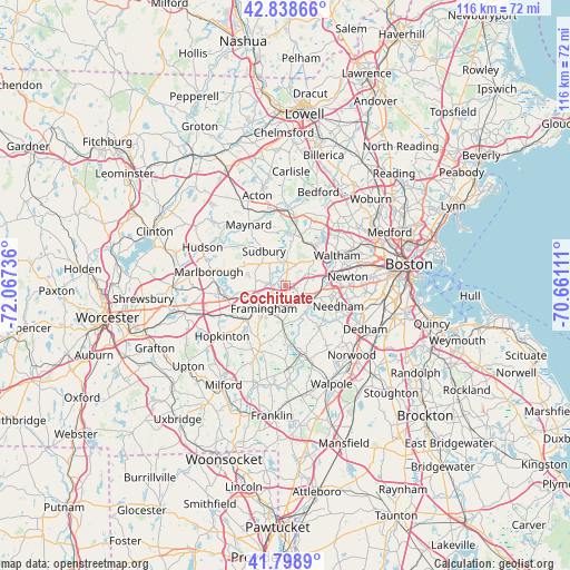
| Upper-left | 42.83866°, | -72.06736° |
| Center: | 42.32093°, | -71.36423° |
| Lower-right: | 41.7989°, | -70.66111° |
| Map W x H: | 115.6×115.6 km | = 71.8×71.8mi |
| max Lat: | 71.29058° ⇑21.7% North |
| Cochituate: | 42.32093° |
| min Lat: | ⇓78.3% South 19.06759° |
| min Long | Cochituate | max Long |
| -171.73463° | -71.36423° | -66.98998° |
| W 96.9%⇐ | ⇒3.1% E |
Elevation
Elevation of Cochituate is 55 m = 180 ft, and this is 239.8 m = 787 ft below average elevation for this country.
| Max E: |
3189 m = 10463 ft | 78.2% |
| Avg. | 294.8 m = 967 ft | |
| Cochituate | 55 m = 180 ft | |
Min E: |
-60 m = -197 ft | 21.8% |
See also: United States elevation on elevation.city.
Geographical zone
Cochituate is located in North temperate zone (between Tropic of Cancer and the Arctic Circle). Distance of this Northern Tropic circle is 2099.7 km =1304.7 mi to South.| Distance of | km | miles | from Cochituate |
|---|---|---|---|
| North Pole | 5301.4 | 3294.1 | to North |
| Arctic Circle | 2695.5 | 1674.9 | to North |
| Tropic Cancer | 2099.7 | 1304.7 | to South |
| Equator | 4705.6 | 2923.9 | to South |


Nearby cities:
15 places around Cochituate: (largest is in red/bold)
• Ashland
10.5 km =6.5 mi,  230°
230°
• Dover
10.7 km =6.6 mi,  141°
141°
• Framingham
6.3 km =3.9 mi,  222°
222°
• Framingham Center
6.5 km =4 mi,  246°
246°
• Lincoln
12.7 km =7.9 mi,  22°
22°
• Natick
4.3 km =2.7 mi,  163°
163°
• Needham
11.6 km =7.2 mi,  111°
111°
• Newton
12.9 km =8 mi,  81°
81°
• Sherborn
9.1 km =5.7 mi,  182°
182°
• Southborough
13.3 km =8.3 mi,  262°
262°
• Sudbury
8.2 km =5.1 mi,  328°
328°
• Waltham
12.2 km =7.6 mi,  59°
59°
• Wayland
4.6 km =2.9 mi,  2°
2°
• Wellesley
6.5 km =4 mi, 114°
• Weston
7.2 km =4.5 mi,  44°
44°
Sources, notices
• [Note1] Compared only with cities in United States existing in our database
• [Src1] Map data: © OpenStreetMap contributors (CC-BY-SA)
• [Src2] Other city data from geonames.org with taken over terms of usage.
• [Src3] Geographical zone / Annual Mean Temperature by Robert A. Rohde @ Wikipedia
