Leominster geodata
Leominster (Massachusetts) is a populated place; located in United States in America/New_York (GMT-4) time zone. With population of 41,569 people, there are 1151 cities with bigger population in this country. Compared to other cities in United States, 80% of cities are located further ↓South; 96.1% of cities are located further ←West and 65.8% of cities have higher elevation than Leominster. Note1
Administrative division(s):
- Level 1: Massachusetts
- Level 2: Worcester County
- Level 3: City of Leominster


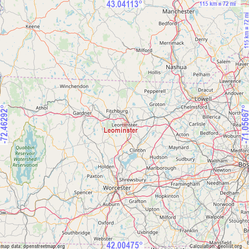
Leominster GPS coordinates[2]
42° 31' 30.324" North, 71° 45' 35.244" West
| Map corner | latitude | longitude |
|---|---|---|
| Upper-left | 43.04113°, | -72.46292° |
| Center: | 42.52509°, | -71.75979° |
| Lower-right: | 42.00475°, | -71.05667° |
| Map W x H: | 115.2×115.2 km | = 71.6×71.6mi |
| max Lat: | 71.29058° ⇑20% North |
| Leominster: | 42.52509° |
| min Lat: | ⇓80% South 19.06759° |
| min Long | Leominster | max Long |
| -171.73463° | -71.75979° | -66.98998° |
| W 96.1%⇐ | ⇒3.9% E |
Elevation
Elevation of Leominster is 124 m = 407 ft, and this is 170.8 m = 560 ft below average elevation for this country.
| Max E: |
3189 m = 10463 ft | 65.8% |
| Avg. | 294.8 m = 967 ft | |
| Leominster | 124 m = 407 ft | |
Min E: |
-60 m = -197 ft | 34.2% |
See also: Leominster elevation on elevation.city.
Geographical zone
Leominster is located in North temperate zone (between Tropic of Cancer and the Arctic Circle). Distance of this Northern Tropic circle is 2122.4 km =1318.8 mi to South.| Distance of | km | miles | from Leominster |
|---|---|---|---|
| North Pole | 5278.7 | 3280 | to North |
| Arctic Circle | 2672.8 | 1660.8 | to North |
| Tropic Cancer | 2122.4 | 1318.8 | to South |
| Equator | 4728.3 | 2938 | to South |


Nearby cities:
15 places around Leominster: (largest is in red/bold)
• Ayer
14.5 km =9 mi,  73°
73°
• Bolton
16.1 km =10 mi,  129°
129°
• Boylston
15.5 km =9.6 mi,  162°
162°
• Clinton
13.6 km =8.5 mi,  152°
152°
• Devens
12.2 km =7.6 mi,  79°
79°
• Fitchburg
7.4 km =4.6 mi,  331°
331°
• Harvard
14.8 km =9.2 mi,  100°
100°
• Lancaster
10.5 km =6.5 mi,  137°
137°
• Lunenburg
8.2 km =5.1 mi,  20°
20°
• Princeton
12.8 km =8 mi,  228°
228°
• Shirley
9.3 km =5.8 mi, 77°
• South Lancaster
10.8 km =6.7 mi, 146°
• Sterling
9.7 km =6 mi,  180°
180°
• Townsend
16.4 km =10.2 mi, 15°
• Westminster
12.6 km =7.8 mi,  280°
280°
Sources, notices
• [Note1] Compared only with cities in United States existing in our database
• [Src1] Map data: © OpenStreetMap contributors (CC-BY-SA)
• [Src2] Other city data from geonames.org with taken over terms of usage.
• [Src3] Geographical zone / Annual Mean Temperature by Robert A. Rohde @ Wikipedia
