Methuen geodata
Methuen (Massachusetts) is a populated place; located in United States in America/New_York (GMT-4) time zone. With population of 47,255 people, there are 1019 cities with bigger population in this country. Compared to other cities in United States, 81.4% of cities are located further ↓South; 97.2% of cities are located further ←West and 81.8% of cities have higher elevation than Methuen. Note1
Administrative division(s):
- Level 1: Massachusetts
- Level 2: Essex County
- Level 3: City of Methuen Town


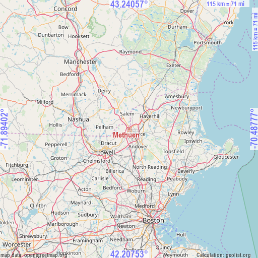
Methuen GPS coordinates[2]
42° 43' 34.32" North, 71° 11' 27.204" West
| Map corner | latitude | longitude |
|---|---|---|
| Upper-left | 43.24057°, | -71.89402° |
| Center: | 42.7262°, | -71.19089° |
| Lower-right: | 42.20753°, | -70.48777° |
| Map W x H: | 114.9×114.9 km | = 71.4×71.4mi |
| max Lat: | 71.29058° ⇑18.6% North |
| Methuen: | 42.7262° |
| min Lat: | ⇓81.4% South 19.06759° |
| min Long | Methuen | max Long |
| -171.73463° | -71.19089° | -66.98998° |
| W 97.2%⇐ | ⇒2.8% E |
Elevation
Elevation of Methuen is 39 m = 128 ft, and this is 255.8 m = 839 ft below average elevation for this country.
| Max E: |
3189 m = 10463 ft | 81.8% |
| Avg. | 294.8 m = 967 ft | |
| Methuen | 39 m = 128 ft | |
Min E: |
-60 m = -197 ft | 18.2% |
See also: Methuen elevation on elevation.city.
Geographical zone
Methuen is located in North temperate zone (between Tropic of Cancer and the Arctic Circle). Distance of this Northern Tropic circle is 2144.8 km =1332.7 mi to South.| Distance of | km | miles | from Methuen |
|---|---|---|---|
| North Pole | 5256.4 | 3266.2 | to North |
| Arctic Circle | 2650.5 | 1646.9 | to North |
| Tropic Cancer | 2144.8 | 1332.7 | to South |
| Equator | 4750.7 | 2951.9 | to South |


Nearby cities:
15 places around Methuen: (largest is in red/bold)
• Andover
8.7 km =5.4 mi,  149°
149°
• Atkinson
13 km =8.1 mi,  16°
16°
• Boxford
17.4 km =10.8 mi,  114°
114°
• Dracut
11 km =6.8 mi,  235°
235°
• Groveland
13.6 km =8.5 mi,  73°
73°
• Hampstead
16.5 km =10.3 mi,  2°
2°
• Haverhill
10.8 km =6.7 mi,  59°
59°
• Lawrence
3.1 km =1.9 mi,  133°
133°
• Lowell
14.5 km =9 mi,  224°
224°
• North Andover
5.5 km =3.4 mi,  123°
123°
• Pelham
11 km =6.8 mi,  274°
274°
• Plaistow
14.6 km =9.1 mi,  32°
32°
• Salem
7 km =4.3 mi,  353°
353°
• Tewksbury
13.3 km =8.3 mi,  195°
195°
• Windham
12.4 km =7.7 mi,  311°
311°
Sources, notices
• [Note1] Compared only with cities in United States existing in our database
• [Src1] Map data: © OpenStreetMap contributors (CC-BY-SA)
• [Src2] Other city data from geonames.org with taken over terms of usage.
• [Src3] Geographical zone / Annual Mean Temperature by Robert A. Rohde @ Wikipedia
