Coopersville geodata
Coopersville (Michigan) is a populated place; located in United States in America/Detroit (GMT-4) time zone. With population of 4,351 people, there are 7807 cities with bigger population in this country. Compared to other cities in United States, 83.7% of cities are located further ↓South; 53.1% of cities are located further ←West and 50.5% of cities have higher elevation than Coopersville. Note1


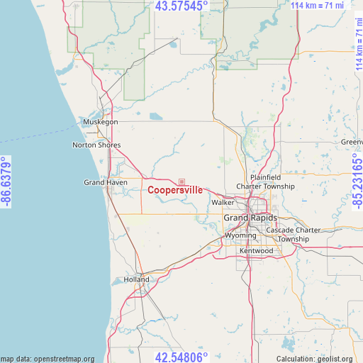
Coopersville GPS coordinates[2]
43° 3' 50.076" North, 85° 56' 5.172" West
| Map corner | latitude | longitude |
|---|---|---|
| Upper-left | 43.57545°, | -86.6379° |
| Center: | 43.06391°, | -85.93477° |
| Lower-right: | 42.54806°, | -85.23165° |
| Map W x H: | 114.2×114.2 km | = 71×71mi |
| max Lat: | 71.29058° ⇑16.3% North |
| Coopersville: | 43.06391° |
| min Lat: | ⇓83.7% South 19.06759° |
| min Long | Coopersville | max Long |
| -171.73463° | -85.93477° | -66.98998° |
| W 53.1%⇐ | ⇒46.9% E |
Elevation
Elevation of Coopersville is 196 m = 643 ft, and this is 98.8 m = 324 ft below average elevation for this country.
| Max E: |
3189 m = 10463 ft | 50.5% |
| Avg. | 294.8 m = 967 ft | |
| Coopersville | 196 m = 643 ft | |
Min E: |
-60 m = -197 ft | 49.5% |
See also: United States elevation on elevation.city.
Geographical zone
Coopersville is located in North temperate zone (between Tropic of Cancer and the Arctic Circle). Distance of this Northern Tropic circle is 2182.3 km =1356 mi to South.| Distance of | km | miles | from Coopersville |
|---|---|---|---|
| North Pole | 5218.8 | 3242.8 | to North |
| Arctic Circle | 2612.9 | 1623.6 | to North |
| Tropic Cancer | 2182.3 | 1356 | to South |
| Equator | 4788.3 | 2975.3 | to South |


Nearby cities:
15 places around Coopersville: (largest is in red/bold)
• Allendale
10.3 km =6.4 mi,  188°
188°
• Comstock Park
21.7 km =13.5 mi,  97°
97°
• Ferrysburg
23.3 km =14.5 mi,  275°
275°
• Fruitport
19.4 km =12.1 mi,  292°
292°
• Grand Haven
23.9 km =14.9 mi,  269°
269°
• Grand Rapids
24.4 km =15.2 mi,  117°
117°
• Grandville
22.1 km =13.7 mi,  140°
140°
• Hudsonville
22.2 km =13.8 mi,  165°
165°
• Jenison
20.9 km =13 mi,  146°
146°
• Kent City
22.9 km =14.2 mi,  40°
40°
• Ravenna
14 km =8.7 mi,  359°
359°
• Sparta
21.2 km =13.2 mi,  59°
59°
• Spring Lake
21.3 km =13.2 mi, 273°
• Walker
15.2 km =9.4 mi, 117°
• Wyoming
25.1 km =15.6 mi,  131°
131°
Sources, notices
• [Note1] Compared only with cities in United States existing in our database
• [Src1] Map data: © OpenStreetMap contributors (CC-BY-SA)
• [Src2] Other city data from geonames.org with taken over terms of usage.
• [Src3] Geographical zone / Annual Mean Temperature by Robert A. Rohde @ Wikipedia
