Dundee geodata
Dundee (Michigan) is a populated place; located in United States in America/Detroit (GMT-4) time zone. With population of 3,994 people, there are 8223 cities with bigger population in this country. Compared to other cities in United States, 75.3% of cities are located further ↓South; 60.2% of cities are located further ←West and 50.7% of cities have lower elevation than Dundee. Note1


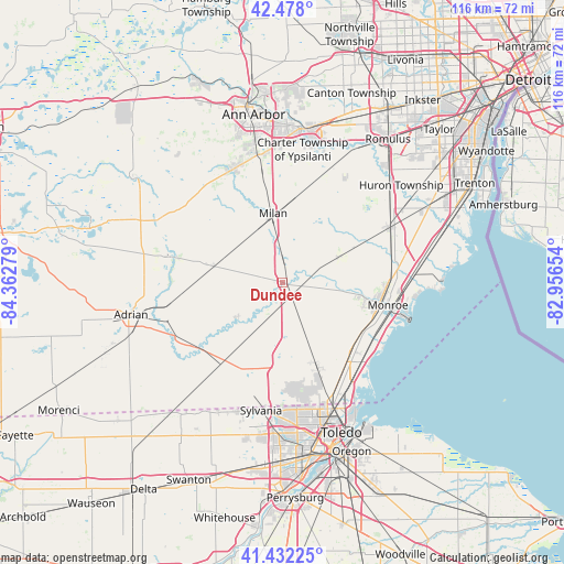
Dundee GPS coordinates[2]
41° 57' 26.172" North, 83° 39' 34.776" West
| Map corner | latitude | longitude |
|---|---|---|
| Upper-left | 42.478°, | -84.36279° |
| Center: | 41.95727°, | -83.65966° |
| Lower-right: | 41.43225°, | -82.95654° |
| Map W x H: | 116.3×116.3 km | = 72.3×72.3mi |
| max Lat: | 71.29058° ⇑24.7% North |
| Dundee: | 41.95727° |
| min Lat: | ⇓75.3% South 19.06759° |
| min Long | Dundee | max Long |
| -171.73463° | -83.65966° | -66.98998° |
| W 60.2%⇐ | ⇒39.8% E |
Elevation
Elevation of Dundee is 201 m = 659 ft, and this is 93.8 m = 308 ft below average elevation for this country.
| Max E: |
3189 m = 10463 ft | 49.3% |
| Avg. | 294.8 m = 967 ft | |
| Dundee | 201 m = 659 ft | |
Min E: |
-60 m = -197 ft | 50.7% |
See also: United States elevation on elevation.city.
Geographical zone
Dundee is located in North temperate zone (between Tropic of Cancer and the Arctic Circle). Distance of this Northern Tropic circle is 2059.3 km =1279.6 mi to South.| Distance of | km | miles | from Dundee |
|---|---|---|---|
| North Pole | 5341.9 | 3319.3 | to North |
| Arctic Circle | 2736 | 1700.1 | to North |
| Tropic Cancer | 2059.3 | 1279.6 | to South |
| Equator | 4665.2 | 2898.8 | to South |


Nearby cities:
15 places around Dundee: (largest is in red/bold)
• Blissfield
21.8 km =13.5 mi,  230°
230°
• Britton
14.5 km =9 mi,  283°
283°
• Carleton
24.9 km =15.5 mi,  62°
62°
• Deerfield
12.4 km =7.7 mi, 232°
• Lambertville
21.4 km =13.3 mi,  172°
172°
• Luna Pier
24.5 km =15.2 mi,  132°
132°
• Maybee
13 km =8.1 mi,  66°
66°
• Milan
14.4 km =8.9 mi,  352°
352°
• Monroe
22.1 km =13.7 mi,  101°
101°
• Petersburg
7.7 km =4.8 mi,  216°
216°
• Saline
25.4 km =15.8 mi,  336°
336°
• South Monroe
21.1 km =13.1 mi,  108°
108°
• Tecumseh
24.1 km =15 mi, 282°
• Temperance
21.2 km =13.2 mi,  159°
159°
• West Monroe
19.5 km =12.1 mi, 104°
Sources, notices
• [Note1] Compared only with cities in United States existing in our database
• [Src1] Map data: © OpenStreetMap contributors (CC-BY-SA)
• [Src2] Other city data from geonames.org with taken over terms of usage.
• [Src3] Geographical zone / Annual Mean Temperature by Robert A. Rohde @ Wikipedia
