Houghton geodata
Houghton (Michigan) is a seat of a second-order administrative division; located in United States in America/Detroit (GMT-4) time zone. With population of 7,970 people, there are 5297 cities with bigger population in this country. Compared to other cities in United States, 96.8% of cities are located further ↓South; 55% of cities are located further →East and 50.3% of cities have higher elevation than Houghton. Note1


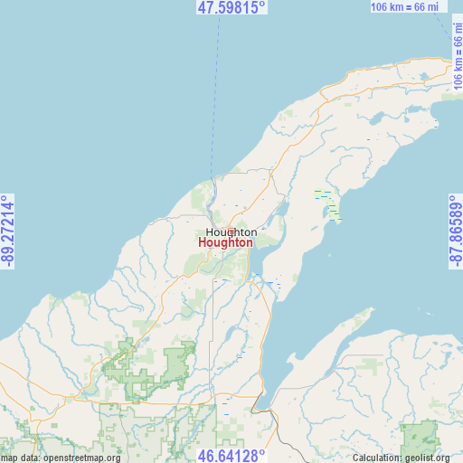
Houghton GPS coordinates[2]
47° 7' 18.732" North, 88° 34' 8.436" West
| Map corner | latitude | longitude |
|---|---|---|
| Upper-left | 47.59815°, | -89.27214° |
| Center: | 47.12187°, | -88.56901° |
| Lower-right: | 46.64128°, | -87.86589° |
| Map W x H: | 106.4×106.4 km | = 66.1×66.1mi |
| max Lat: | 71.29058° ⇑3.2% North |
| Houghton: | 47.12187° |
| min Lat: | ⇓96.8% South 19.06759° |
| min Long | Houghton | max Long |
| -171.73463° | -88.56901° | -66.98998° |
| W 45%⇐ | ⇒55% E |
Elevation
Elevation of Houghton is 197 m = 646 ft, and this is 97.8 m = 321 ft below average elevation for this country.
| Max E: |
3189 m = 10463 ft | 50.3% |
| Avg. | 294.8 m = 967 ft | |
| Houghton | 197 m = 646 ft | |
Min E: |
-60 m = -197 ft | 49.7% |
See also: United States elevation on elevation.city.
Geographical zone
Houghton is located in North temperate zone (between Tropic of Cancer and the Arctic Circle). Distance of this North polar circle is 2161.7 km =1343.2 mi to North.| Distance of | km | miles | from Houghton |
|---|---|---|---|
| North Pole | 4767.6 | 2962.4 | to North |
| Arctic Circle | 2161.7 | 1343.2 | to North |
| Tropic Cancer | 2633.5 | 1636.4 | to South |
| Equator | 5239.5 | 3255.7 | to South |


Nearby cities:
15 places around Houghton: (largest is in red/bold)
• Baraga
38.7 km =24 mi,  170°
170°
• Calumet
16.4 km =10.2 mi,  32°
32°
• Dollar Bay
4.4 km =2.7 mi,  93°
93°
• Eagle River
38.5 km =23.9 mi, 32°
• Hancock
1.1 km =0.7 mi,  301°
301°
• Hubbell
12 km =7.5 mi,  61°
61°
• Ishpeming
98.3 km =61.1 mi,  135°
135°
• L'Anse
41.6 km =25.8 mi, 167°
• Lake Linden
14.6 km =9.1 mi, 56°
• Laurium
16 km =9.9 mi,  36°
36°
• Negaunee
100.5 km =62.4 mi,  133°
133°
• Ontonagon
63 km =39.1 mi,  243°
243°
• Republic
91.5 km =56.9 mi,  150°
150°
• South Range
8.1 km =5 mi,  224°
224°
• West Ishpeming
97 km =60.3 mi, 137°
Sources, notices
• [Note1] Compared only with cities in United States existing in our database
• [Src1] Map data: © OpenStreetMap contributors (CC-BY-SA)
• [Src2] Other city data from geonames.org with taken over terms of usage.
• [Src3] Geographical zone / Annual Mean Temperature by Robert A. Rohde @ Wikipedia
