L'Anse geodata
L'Anse (Michigan) is a seat of a second-order administrative division; located in United States in America/Detroit (GMT-4) time zone. With population of 1,934 people, there are 12130 cities with bigger population in this country. Compared to other cities in United States, 96.2% of cities are located further ↓South; 54.6% of cities are located further →East and 53.1% of cities have higher elevation than L'Anse. Note1


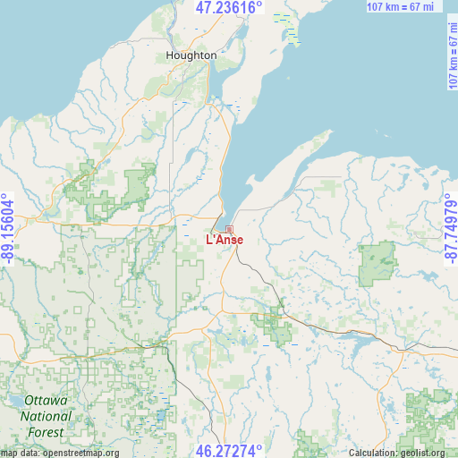
L'Anse GPS coordinates[2]
46° 45' 23.76" North, 88° 27' 10.476" West
| Map corner | latitude | longitude |
|---|---|---|
| Upper-left | 47.23616°, | -89.15604° |
| Center: | 46.7566°, | -88.45291° |
| Lower-right: | 46.27274°, | -87.74979° |
| Map W x H: | 107.1×107.1 km | = 66.5×66.5mi |
| max Lat: | 71.29058° ⇑3.8% North |
| L'Anse: | 46.7566° |
| min Lat: | ⇓96.2% South 19.06759° |
| min Long | L'Anse | max Long |
| -171.73463° | -88.45291° | -66.98998° |
| W 45.4%⇐ | ⇒54.6% E |
Elevation
Elevation of L'Anse is 187 m = 614 ft, and this is 107.8 m = 354 ft below average elevation for this country.
| Max E: |
3189 m = 10463 ft | 53.1% |
| Avg. | 294.8 m = 967 ft | |
| L'Anse | 187 m = 614 ft | |
Min E: |
-60 m = -197 ft | 46.9% |
See also: United States elevation on elevation.city.
Geographical zone
L'Anse is located in North temperate zone (between Tropic of Cancer and the Arctic Circle). Distance of this North polar circle is 2202.3 km =1368.4 mi to North.| Distance of | km | miles | from L'Anse |
|---|---|---|---|
| North Pole | 4808.2 | 2987.7 | to North |
| Arctic Circle | 2202.3 | 1368.4 | to North |
| Tropic Cancer | 2592.9 | 1611.2 | to South |
| Equator | 5198.8 | 3230.4 | to South |


Nearby cities:
15 places around L'Anse: (largest is in red/bold)
• Baraga
3.7 km =2.3 mi,  311°
311°
• Calumet
54.5 km =33.9 mi,  359°
359°
• Crystal Falls
73.8 km =45.9 mi,  172°
172°
• Dollar Bay
40.6 km =25.2 mi,  353°
353°
• Hancock
42.3 km =26.3 mi, 346°
• Houghton
41.6 km =25.8 mi, 347°
• Hubbell
46.4 km =28.8 mi,  2°
2°
• Ishpeming
67 km =41.6 mi,  116°
116°
• Lake Linden
48.8 km =30.3 mi, 4°
• Laurium
53.5 km =33.2 mi, 0°
• Negaunee
70.3 km =43.7 mi,  114°
114°
• Ontonagon
66.8 km =41.5 mi,  280°
280°
• Republic
53.3 km =33.1 mi,  136°
136°
• South Range
37.7 km =23.4 mi,  337°
337°
• West Ishpeming
65 km =40.4 mi, 117°
Sources, notices
• [Note1] Compared only with cities in United States existing in our database
• [Src1] Map data: © OpenStreetMap contributors (CC-BY-SA)
• [Src2] Other city data from geonames.org with taken over terms of usage.
• [Src3] Geographical zone / Annual Mean Temperature by Robert A. Rohde @ Wikipedia
