Middletown geodata
Middletown (Michigan) is a populated place; located in United States in America/Detroit (GMT-4) time zone. With population of 897 people, there are 17001 cities with bigger population in this country. Compared to other cities in United States, 83.2% of cities are located further ↓South; 58.8% of cities are located further ←West and 57.5% of cities have lower elevation than Middletown. Note1
Administrative division(s):
- Level 1: Michigan
- Level 2: Shiawassee County
- Level 3: Charter Township of Caledonia


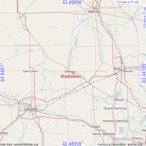
Middletown GPS coordinates[2]
42° 59' 9.096" North, 84° 8' 41.892" West
| Map corner | latitude | longitude |
|---|---|---|
| Upper-left | 43.49806°, | -84.8481° |
| Center: | 42.98586°, | -84.14497° |
| Lower-right: | 42.46936°, | -83.44185° |
| Map W x H: | 114.4×114.4 km | = 71.1×71.1mi |
| max Lat: | 71.29058° ⇑16.8% North |
| Middletown: | 42.98586° |
| min Lat: | ⇓83.2% South 19.06759° |
| min Long | Middletown | max Long |
| -171.73463° | -84.14497° | -66.98998° |
| W 58.8%⇐ | ⇒41.2% E |
Elevation
Elevation of Middletown is 228 m = 748 ft, and this is 66.8 m = 219 ft below average elevation for this country.
| Max E: |
3189 m = 10463 ft | 42.5% |
| Avg. | 294.8 m = 967 ft | |
| Middletown | 228 m = 748 ft | |
Min E: |
-60 m = -197 ft | 57.5% |
See also: United States elevation on elevation.city.
Geographical zone
Middletown is located in North temperate zone (between Tropic of Cancer and the Arctic Circle). Distance of this Northern Tropic circle is 2173.7 km =1350.7 mi to South.| Distance of | km | miles | from Middletown |
|---|---|---|---|
| North Pole | 5227.5 | 3248.2 | to North |
| Arctic Circle | 2621.6 | 1629 | to North |
| Tropic Cancer | 2173.7 | 1350.7 | to South |
| Equator | 4779.6 | 2969.9 | to South |


Nearby cities:
15 places around Middletown: (largest is in red/bold)
• Bancroft
13.6 km =8.5 mi,  151°
151°
• Byron
24.4 km =15.2 mi,  137°
137°
• Chesaning
22.2 km =13.8 mi,  6°
6°
• Corunna
2.3 km =1.4 mi,  101°
101°
• Durand
15.4 km =9.6 mi,  122°
122°
• Elsie
22.7 km =14.1 mi,  300°
300°
• Laingsburg
19.9 km =12.4 mi,  237°
237°
• Lennon
17.5 km =10.9 mi,  90°
90°
• Morrice
16.6 km =10.3 mi,  189°
189°
• New Haven
12 km =7.5 mi,  356°
356°
• New Lothrop
20.3 km =12.6 mi,  44°
44°
• Ovid
18.6 km =11.6 mi,  276°
276°
• Owosso
2.9 km =1.8 mi, 297°
• Perry
18.7 km =11.6 mi,  198°
198°
• Vernon
10.7 km =6.6 mi, 118°
Sources, notices
• [Note1] Compared only with cities in United States existing in our database
• [Src1] Map data: © OpenStreetMap contributors (CC-BY-SA)
• [Src2] Other city data from geonames.org with taken over terms of usage.
• [Src3] Geographical zone / Annual Mean Temperature by Robert A. Rohde @ Wikipedia
