Oxford geodata
Oxford (Michigan) is a populated place; located in United States in America/Detroit (GMT-4) time zone. With population of 3,534 people, there are 8823 cities with bigger population in this country. Compared to other cities in United States, 82% of cities are located further ↓South; 61.3% of cities are located further ←West and 76.5% of cities have lower elevation than Oxford. Note1
Administrative division(s):
- Level 1: Michigan
- Level 2: Oakland County
- Level 3: Charter Township of Oxford


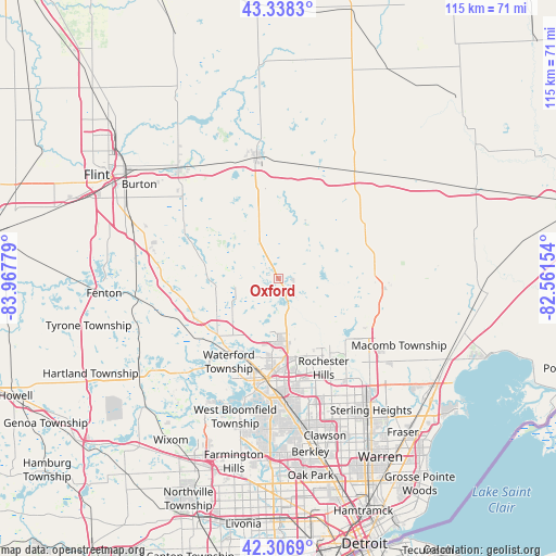
Oxford GPS coordinates[2]
42° 49' 29.1" North, 83° 15' 52.776" West
| Map corner | latitude | longitude |
|---|---|---|
| Upper-left | 43.3383°, | -83.96779° |
| Center: | 42.82475°, | -83.26466° |
| Lower-right: | 42.3069°, | -82.56154° |
| Map W x H: | 114.7×114.7 km | = 71.3×71.3mi |
| max Lat: | 71.29058° ⇑18% North |
| Oxford: | 42.82475° |
| min Lat: | ⇓82% South 19.06759° |
| min Long | Oxford | max Long |
| -171.73463° | -83.26466° | -66.98998° |
| W 61.3%⇐ | ⇒38.7% E |
Elevation
Elevation of Oxford is 324 m = 1063 ft, and this is 29.2 m = 96 ft above average elevation for this country.
| Max E: |
3189 m = 10463 ft | 23.5% |
| Oxford | 324 m 1063 ft | |
| Avg. | 294.8 m = 967 ft | |
Min E: |
-60 m = -197 ft | 76.5% |
See also: United States elevation on elevation.city.
Geographical zone
Oxford is located in North temperate zone (between Tropic of Cancer and the Arctic Circle). Distance of this Northern Tropic circle is 2155.7 km =1339.5 mi to South.| Distance of | km | miles | from Oxford |
|---|---|---|---|
| North Pole | 5245.4 | 3259.3 | to North |
| Arctic Circle | 2639.5 | 1640.1 | to North |
| Tropic Cancer | 2155.7 | 1339.5 | to South |
| Equator | 4761.7 | 2958.8 | to South |


Nearby cities:
15 places around Oxford: (largest is in red/bold)
• Almont
20.8 km =12.9 mi,  59°
59°
• Attica
24.2 km =15 mi,  19°
19°
• Auburn Hills
15.5 km =9.6 mi,  170°
170°
• Clarkston
16 km =9.9 mi,  231°
231°
• Dryden
17.7 km =11 mi,  40°
40°
• Goodrich
22.2 km =13.8 mi,  297°
297°
• Lake Orion
4.9 km =3 mi,  155°
155°
• Metamora
13.1 km =8.1 mi,  351°
351°
• Ortonville
14.9 km =9.3 mi,  281°
281°
• Pontiac
20.8 km =12.9 mi,  185°
185°
• Rochester
19.3 km =12 mi,  146°
146°
• Rochester Hills
20.7 km =12.9 mi, 153°
• Romeo
20.7 km =12.9 mi,  96°
96°
• Sylvan Lake
24.3 km =15.1 mi, 192°
• Waterford
18.9 km =11.7 mi,  219°
219°
Sources, notices
• [Note1] Compared only with cities in United States existing in our database
• [Src1] Map data: © OpenStreetMap contributors (CC-BY-SA)
• [Src2] Other city data from geonames.org with taken over terms of usage.
• [Src3] Geographical zone / Annual Mean Temperature by Robert A. Rohde @ Wikipedia
