Waterford geodata
Waterford (Michigan) is a populated place; located in United States in America/Detroit (GMT-4) time zone. With population of 75,737 people, there are 533 cities with bigger population in this country. Compared to other cities in United States, 81.2% of cities are located further ↓South; 60.8% of cities are located further ←West and 73.1% of cities have lower elevation than Waterford. Note1
Administrative division(s):
- Level 1: Michigan
- Level 2: Oakland County
- Level 3: Charter Township of Waterford


Waterford GPS coordinates[2]
42° 41' 34.908" North, 83° 24' 42.516" West
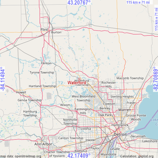
| Map corner | latitude | longitude |
|---|---|---|
| Upper-left | 43.20767°, | -84.11494° |
| Center: | 42.69303°, | -83.41181° |
| Lower-right: | 42.17409°, | -82.70869° |
| Map W x H: | 114.9×114.9 km | = 71.4×71.4mi |
| max Lat: | 71.29058° ⇑18.8% North |
| Waterford: | 42.69303° |
| min Lat: | ⇓81.2% South 19.06759° |
| min Long | Waterford | max Long |
| -171.73463° | -83.41181° | -66.98998° |
| W 60.8%⇐ | ⇒39.2% E |
Elevation
Elevation of Waterford is 302 m = 991 ft, and this is 7.2 m = 24 ft above average elevation for this country.
| Max E: |
3189 m = 10463 ft | 26.9% |
| Waterford | 302 m 991 ft | |
| Avg. | 294.8 m = 967 ft | |
Min E: |
-60 m = -197 ft | 73.1% |
See also: Waterford elevation on elevation.city.
Geographical zone
Waterford is located in North temperate zone (between Tropic of Cancer and the Arctic Circle). Distance of this Northern Tropic circle is 2141.1 km =1330.4 mi to South.| Distance of | km | miles | from Waterford |
|---|---|---|---|
| North Pole | 5260 | 3268.4 | to North |
| Arctic Circle | 2654.2 | 1649.2 | to North |
| Tropic Cancer | 2141.1 | 1330.4 | to South |
| Equator | 4747 | 2949.6 | to South |


Nearby cities:
15 places around Waterford: (largest is in red/bold)
• Auburn Hills
14.5 km =9 mi,  92°
92°
• Bloomfield Hills
18.2 km =11.3 mi,  131°
131°
• Clarkston
4.8 km =3 mi,  353°
353°
• Holly
20.8 km =12.9 mi,  301°
301°
• Keego Harbor
11 km =6.8 mi,  149°
149°
• Lake Orion
17.4 km =10.8 mi,  54°
54°
• Milford
18.9 km =11.7 mi,  234°
234°
• Orchard Lake
13 km =8.1 mi,  160°
160°
• Ortonville
17.9 km =11.1 mi, 351°
• Oxford
18.9 km =11.7 mi,  39°
39°
• Pontiac
11.6 km =7.2 mi,  121°
121°
• Sylvan Lake
11.3 km =7 mi,  143°
143°
• Walled Lake
18.2 km =11.3 mi,  198°
198°
• West Bloomfield Township
14 km =8.7 mi,  170°
170°
• Wolverine Lake
16 km =9.9 mi, 198°
Sources, notices
• [Note1] Compared only with cities in United States existing in our database
• [Src1] Map data: © OpenStreetMap contributors (CC-BY-SA)
• [Src2] Other city data from geonames.org with taken over terms of usage.
• [Src3] Geographical zone / Annual Mean Temperature by Robert A. Rohde @ Wikipedia
