Deerwood geodata
Deerwood (Minnesota) is a populated place; located in United States in America/Chicago (GMT-5) time zone. With population of 520 people, there are 20628 cities with bigger population in this country. Compared to other cities in United States, 95.8% of cities are located further ↓South; 68.4% of cities are located further →East and 82.7% of cities have lower elevation than Deerwood. Note1


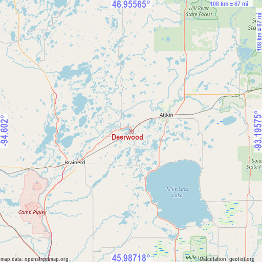
Deerwood GPS coordinates[2]
46° 28' 24.852" North, 93° 53' 55.932" West
| Map corner | latitude | longitude |
|---|---|---|
| Upper-left | 46.95565°, | -94.602° |
| Center: | 46.47357°, | -93.89887° |
| Lower-right: | 45.98718°, | -93.19575° |
| Map W x H: | 107.7×107.7 km | = 66.9×66.9mi |
| max Lat: | 71.29058° ⇑4.2% North |
| Deerwood: | 46.47357° |
| min Lat: | ⇓95.8% South 19.06759° |
| min Long | Deerwood | max Long |
| -171.73463° | -93.89887° | -66.98998° |
| W 31.6%⇐ | ⇒68.4% E |
Elevation
Elevation of Deerwood is 386 m = 1266 ft, and this is 91.2 m = 299 ft above average elevation for this country.
| Max E: |
3189 m = 10463 ft | 17.3% |
| Deerwood | 386 m 1266 ft | |
| Avg. | 294.8 m = 967 ft | |
Min E: |
-60 m = -197 ft | 82.7% |
See also: United States elevation on elevation.city.
Geographical zone
Deerwood is located in North temperate zone (between Tropic of Cancer and the Arctic Circle). Distance of this North polar circle is 2233.8 km =1388 mi to North.| Distance of | km | miles | from Deerwood |
|---|---|---|---|
| North Pole | 4839.7 | 3007.2 | to North |
| Arctic Circle | 2233.8 | 1388 | to North |
| Tropic Cancer | 2561.5 | 1591.6 | to South |
| Equator | 5167.4 | 3210.9 | to South |


Nearby cities:
15 places around Deerwood: (largest is in red/bold)
• Aitkin
15.9 km =9.9 mi,  65°
65°
• Baxter
33.1 km =20.6 mi,  244°
244°
• Brainerd
26.5 km =16.5 mi, 240°
• Breezy Point
27.8 km =17.3 mi,  297°
297°
• Crosby
4.6 km =2.9 mi,  281°
281°
• Cross Lake
26.4 km =16.4 mi,  321°
321°
• East Gull Lake
35.8 km =22.2 mi,  258°
258°
• Emily
29 km =18 mi,  351°
351°
• Ironton
6.1 km =3.8 mi,  274°
274°
• Lake Shore
35.4 km =22 mi, 272°
• Nisswa
30.3 km =18.8 mi, 279°
• Onamia
48.2 km =30 mi,  158°
158°
• Pequot Lakes
34.5 km =21.4 mi,  294°
294°
• Pine River
47.2 km =29.3 mi,  305°
305°
• Vineland
36.1 km =22.4 mi, 162°
Sources, notices
• [Note1] Compared only with cities in United States existing in our database
• [Src1] Map data: © OpenStreetMap contributors (CC-BY-SA)
• [Src2] Other city data from geonames.org with taken over terms of usage.
• [Src3] Geographical zone / Annual Mean Temperature by Robert A. Rohde @ Wikipedia
